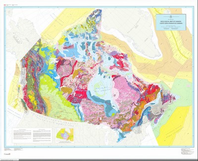
In 1996, the Geological Survey of Canada published a new Geological Map of Canada, the first since 1969. Canada had been mapped more extensively and in greater detail during that time - for example, the new map was the first to include the bedrock geology under the Great Lakes and of the offshore oceanic crust. There had also been fundamental advances in scientific knowledge. Notably, plate tectonics had become the unifying theory of crustal evolution and refined isotopic methods allowed the ages of rocks to be determined with great precision.
As a result, the new map reflected the revised understanding that rather than having evolved in place, the Canadian landmass is a collage of many crustal fragments juxtaposed together through geological time.
Compiled under the leadership of former Chief Geologist J.O. Wheeler, the map integrated the work of hundreds of geoscientists from the Survey, provincial and territorial surveys, and academia. It was produced using new digital cartographic techniques and became one of the most frequently downloaded Survey products.
Category: Maps
Decade: 1990s
Reference


