
Text and photos by Vivien Cumming – @drvivcumming
For this post we thought we’d give you an idea of what a typical day is like in the field for a geologist in the Arctic. Of course, every day is different, but here is an example.
7:02 Alarm goes off; it’s already bright daylight outside.
7:26 The camp “rooster” lets out his call — breakfast is ready — get up, unzip the down sleeping bag to let in the bracing Arctic air and get dressed.
7:33 Breakfast: coffee, tea, eggs and bacon, oatmeal or some other delicious concoction created by our fantastic canoe guides, with cinnamon buns on a really good day!
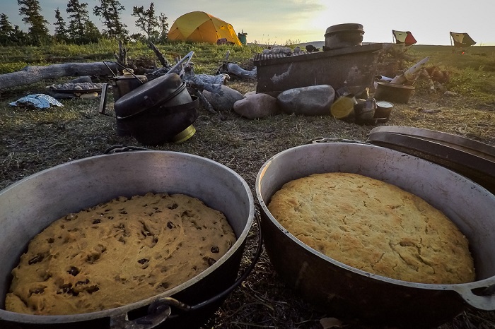
Photo 1: Freshly baked bread to keep us going.
8:11 More coffee.
8:17 Toilet shuttles begin: take the camp spade, dig a hole, do your business.
8:34 Bags packed with field gear — waterproofs, warm layers, cameras, notebooks, rock hammers, sample bags, first aid kits, bear spray, flares and bear bangers, emergency blankets, field computers — lunch and trail mix ready for a day in the wild.
9:13 Head off into the field. We camp by the river, and the rocks are usually in the mountains so there are a fair few kilometres to hike through forest and across bogs to get to what we want to see, swatting away the bugs as we go.
10:56 Reach the first rocky outcrop. Today, we’re sampling layers and layers of lava that make up the mountains. On other days, we’ve been measuring sedimentary structures left by ancient rivers or collecting samples of organic matter–rich chert, a type of sedimentary rock, to look for evidence of early life.
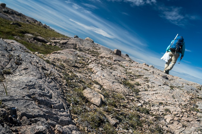
Photo 2 - Hiking out across the landscape with equipment on the back.
11:07 Tom Skulski gets out his hand lens (a mini magnifying glass) and examines the crystals in the rocks to find out their composition.
11:23 We sample the central part of the lava flow. You can tell where this by finding the part of the outcrop that has the least holes in it; these are called vesicles and are produced by bubbles of gas that rise to the top of the flow captured in time when the flow cools.
11:33 The samples is are bagged, and GPS coordinates are logged and input into the field computer. This allows the locations to be plotted up on a geological and topographic map to assess how many more flows need to be sampled and to see the geographical distribution of the samples.
12:49 Three more flows have been sampled, and we have reached the top of the mountain. It’s time for lunch overlooking a huge bend in the Coppermine River, aptly named Big Bend.
13:19 We trace the top of one lava flow across a large glacial valley to another mountain, and it seems there are more lava flows to go and sample.
13:31 Étienne Girard launches a tiny drone helicopter to capture high-resolution 3D images of the flows, which will help us reconstruct their original pathways.
13:45 Étienne flies the drone over the back of a ridge so we can see if there are more flows to sample on the other side.

Photo 3 - Looking over the Coppermine River.
14:12 There are more flows to sample, so we pack up the drone, leave the previous samples in a big white bag to find them on our way back and hike off across the valley tracing out more lava flows.
16:34 We have sampled all the flows that have led us to the top of a mountain, and we stop to take in the view over the winding Coppermine River.
16:47 A quick snack and then it’s a long walk back to camp, picking up samples along the way, watching out for wildlife and swatting away more bugs.
19:04 Arrive back in camp, tired after our long walk.
19:14 A quick river wash in the cold water — there’s nothing like refreshing ice cold water to wash away a long day hiking.
19:37 Dinner is ready. Our canoe guides, Jess, Chris, Dylan and John, must be thanked for their incredible and ingenious cooking. We would all agree that we have never eaten so well in the field before. Dutch oven roast beef beats freeze dried camping meals any day!

Photo 4 - Camp life.
20:49 The daily notes are written up and recorded, GPS points are input into field computers, and geological maps are studied to search for our next target. Some scrabble and card games also go on in the background.
22:11 Get ready for bed. The eternal Arctic light in the summer makes it hard to know when night falls, but a long day in the field is enough to put you straight to sleep.
This describes a particular day in the field, but every day is different and every rock type requires different methods.