Sulphur dioxide (SO2) is a common air pollutant in Canada. These emissions lead to the formation of sulfuric acid and fine particulate matter, which are associated with negative health outcomes such as cardiovascular disease and environmental impacts such as acid rain. The next steps by the Government of Canada to further reduce these emissions will require a thorough understanding of air pollution sources and science has an important role to play.
In spring 2016, Environment and Climate Change Canada (ECCC) scientists, in collaboration with scientists from NASA and Canadian and American universities, published a paper in the journal Nature Geoscience, which summarizes a new method for detecting, mapping, and calculating the amount of air pollutant emissions in our atmosphere. This method uses space-based observations, also known as satellite remote sensing, to measure ground-level sources of SO2 air emissions. Such sources include small and large industrial facilities and naturally-occurring sources such as volcanoes.
"We now have an independent measurement of these emission sources that does not rely on what was known or thought known," said Chris McLinden, an atmospheric scientist with ECCC in Toronto and lead author of the study. "When you look at a satellite picture of sulphur dioxide, you end up with it appearing as hotspots – bullseyes, in effect -- which makes the estimates of emissions easier."
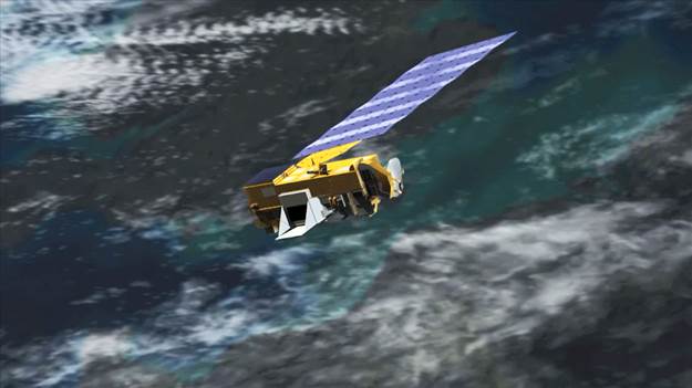
The scientists used a decade of data from the Ozone Monitoring Instrument attached to NASA’s Aura satellite, with a focus on the year 2008.

Data from NASA’s Aura spacecraft, illustrated here, were analyzed by scientists to produce improved estimates of sulphur dioxide sources and concentrations worldwide between 2005 and 2014. Credit: NASA
Using new analysis techniques, the scientists were able to detect smaller concentrations of SO2 emissions than had been possible in the past. This led to another breakthrough: being able to more precisely detect SO2 emissions, completely independent of what was previously reported (or not reported). The scientists used wind strength and direction to trace the pollutant back to the source so they could estimate how much SO2 was emitted from each site. The result was the first ever satellite-derived, global emissions inventory.
Canadian Results
As part of the verification process, the satellite data results were first verified against known sources of SO2 that are reported each year to ECCC by industry through the National Pollutant Release Inventory.
The results from the satellite data showed that total Canadian SO2 emissions decreased significantly between 2005 and 2014. This result aligns with downward trends already observed in Canada’s annual emissions inventory. The satellite data results also provided an independent verification of the effectiveness of past regulations and international agreements on air quality, for example, Canadian fuel regulations that have reduced the amount of sulphur, and the Canada-United States Air Quality Agreement that has helped to reduce the transboundary flow of air pollutants into Canada.
International Results
The research identified approximately 500 sulphur dioxide emission sources, with about 40 of these not captured in leading international emission inventories. These missing emission sources include coal-burning power plants, smelters, and oil and gas operations, and they tended to appear in clusters – notably in the Middle East, but also in Mexico and parts of Russia. In addition, emissions from the reported known sources in these regions were sometimes two to three times lower than the satellite-based estimate for those sources. Overall emissions from these new, or missing, SO2 sources represent roughly 12% of global SO2 emissions.
While this is not necessarily that significant on the global scale, these missing sources can have a large impact on regional and local air quality.
The research team also located 75 natural SO2 emissions sources, which included dormant volcanoes slowly leaking SO2 throughout the year. Since many volcanoes are in remote locations and are not monitored, this satellite-based data set is the first that will be able to provide regular annual information on passive volcanic emissions.
Next steps
The results of this research will improve the accuracy of air quality models, including those used by meteorologists at ECCC to prepare the daily Air Quality Health Index forecasts. Satellite measurements of air pollution will also assist researchers to better understand the long-term impacts of emissions on human health and the environment.
Scientists also determined that this satellite-based detection and mapping method, developed for SO2, can also be used for nitrogen dioxide and potentially for ammonia, particulate matter and other short-lived pollutants.
Satellite remote sensing for SO2 emissions is an example of innovative environmental monitoring that shows Canada supports science and air quality management based on evidence. The methods, satellite data and meteorological data used by the research team are freely available.

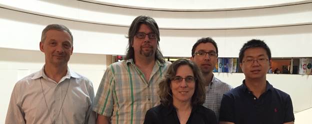
Nicolay Krotkov (NASA), Chris McLinden (ECCC), Joanna Joiner (NASA), Randall Martin (Dalhousie University) and Can Li (NASA and University of Maryland) collaborated on the Nature Geoscience paper [missing: Vitali Fioletov (ECCC), Michael Moran (ECCC), and Mark Shephard (ECCC)].
