
Last year's E-postcards from the Arctic blog was a huge success! The blog features some of the science projects that Natural Resources Canada's (NRCan) Polar Continental Shelf Program (PCSP) helps researchers to conduct safely in the Canadian Arctic. This year, we enjoy field experiences on the new blog, E-postcards from the Field. This blog will include research being done in northern and remote parts of the country, as well as other sites across Canada or in laboratories and offices.
Table of Contents
- Less snow is more when you need ice roads
- A Different Kind of Field Trip
- A billion year old tale archived in stone
- Energy from flowing water!
- Data...Data Everywhere!
- Shining new light on solar energy
- From waste to fuel
- Finding Chlorine
- Tent Life
- Always have an eye out for Polar Bears!
- New ice cores, new clues
- Red field clothes for surveys on Canada Day (it was pre-planned! #canadanerds #thebirdsdonotknowitisaholiday)
- Semipalmated Sandpiper nest, well camouflaged eggs
- Attack by a nesting jaeger
- Releasing a Black-bellied Plover fitted with a satellite backpack
- Snowy Owl chicks with lots of lemmings for food
- The remains of a bull muskox killed by a wolf pack on Axel Heiberg Island
- Backpacking camp on Axel Heiberg Island
- Local knowledge meets western science
- Peary caribou and muskox survey
- Wolf pups at the Vesle Fiord den
- Curious Peary caribou bulls
- Colleen and Caroline - a double on tundra.
Less snow is more when you need ice roads
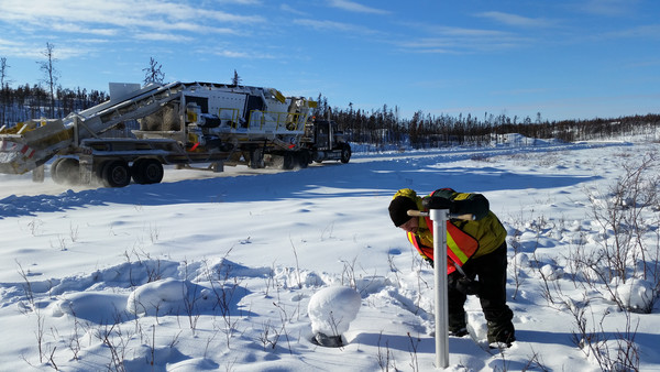
Snow insulates the Earth's surface from freezing winter air temperatures, with thin, compact snow cover providing less insulation than deep, fluffy snow. Snow cover is therefore a dominant control on the degree of ground and ice freezing each winter, which has significant implications for winter road construction and operation. Here Landen Powell of the Northwest Territories Geological Survey, working in collaboration with Peter Morse of the Geological Survey of Canada, surveys snow cover conditions at Portage 10 of the 600-km long Tibbitt to Contwoyto Winter Road, 19 February 2016, -30 degrees C. Both were happy for the sun and lack of wind.
photo by Peter Morse
A Different Kind of Field Trip
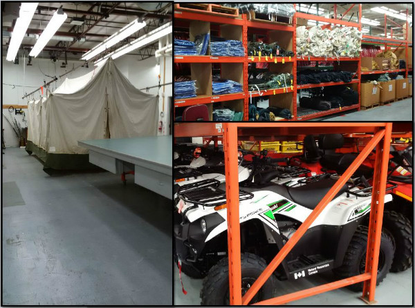
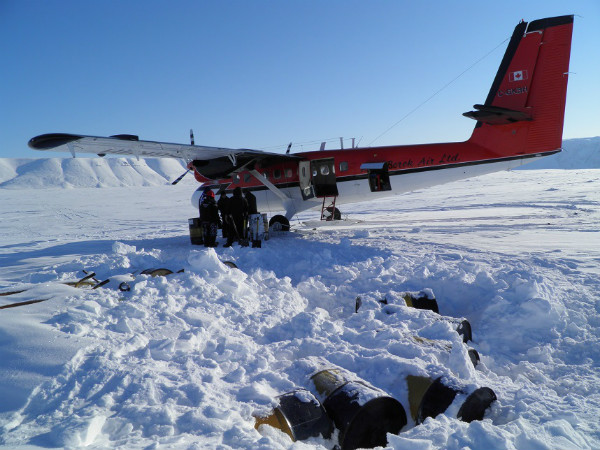
Unlike my research colleagues, my job doesn't often take me far from my office - I don't have a lab or conduct field work in Canada's vast North. Recently though, I had the opportunity to visit the Polar Continental Shelf's (PCSP) Logistics Hub; a large warehouse where PCSP manages the field equipment for researchers from government and academia travelling to remote locations.
The warehouse has everything you'd ever want or need - from kitchen supplies to parkas and boots to tents and ATV's. And the best part? No packing! The staff at the Logistics Hub do it all for you; they even handle your tent's dry cleaning.
Photo by Laura Sheppard
A billion year old tale archived in stone
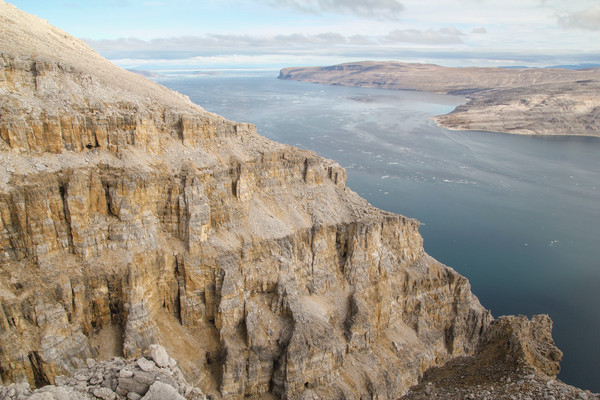
The ca. 1 billion year old Angmaat Formation exposed along the coast of northern Baffin Island is a critical archive of information recording early eukaryotic diversification and changes in ocean chemistry, as well as the tectonic evolution of northern Canada spanning supercontinent Rodinia's assembly and break-up.
Photo Credit: Timothy Gibson
Research Project: The Record of Eukaryotic Diversification in the late Mesoproterozoic (ca. 1 billion years ago) Bylot Supergroup, Baffin Island.
Approximately one billion year ago, Earth's surface began a slow but inexorable transition from a low biological diversity, low oxygen environment to one with a thriving and diverse biosphere. Baffin Island is one of few places in the world where ca. 1 billion-year-old sedimentary rocks are well preserved and accessible. The purpose of this project is to interrogate and calibrate this sedimentary record to better understand the nature of this critical stage in the Earth's history that ushered in the age of eukaryotes (A eukaryote is an organism with a complex cell or cells, in which the genetic material is organized into a membrane-bound nucleus or nuclei.[i]) and to document the geochemical footprint of these early eukaryotes.
Research Team: McGill University - Galen Halverson, Peter Crockford, Vivien Cumming, Timothy Gibson, Malcolm Hodgskiss, Marcus Kunzmann, and Sarah Wörndle.
http://props.eps.mcgill.ca/people.html
Energy from flowing water!
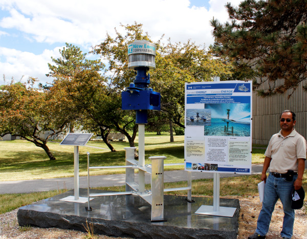
This is a Canadian made 5kW rated water turbine that can extract energy from the flowing water current, without impacting the river and eco system. If you like to see it and learn more come over to Bells Corners Complex.
Photo: Emily Fielden, Business Office, CanmetENERGY Ottawa
Field of Study and Institution: Ghanashyam Ranjitkar is a Research Engineer with the Buildings and Renewables Group, CanmetENERGY-Ottawa
Data...Data Everywhere!
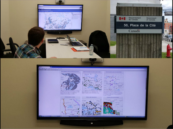
This may be the closest I get to being in the field - visiting the Natural Resources Canada (NRCan) Geobase Division at their office in Sherbrooke, Québec.
A few things I learned on my trip:
1) Geospatial data is an unsung hero - we benefit from it every day without even realizing it!
2) The Geobase Division provides FREE access to geospatial data to all Canadians!
A big thanks to the Geobase staff for welcoming me and showing me the value of geospatial data!
Profile : Matthieu Péloquin is the newest member of NRCan's S & T Liaison Office within the Earth Sciences Sector. He and the team work with NRCan's scientists and technologists to share their expertise in plain language.
Photo credit: Matthieu Péloquin
Shining new light on solar energy
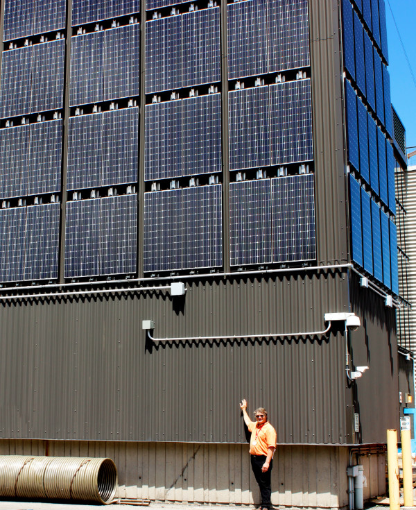
This vertical Solarwall captures solar energy to preheat air used for ventilation in one of the buildings at CanmetENERGY-Ottawa's Bells Corners Complex. The photovoltaic (PV) panels generate electricity while releasing heat that the Solarwall captures in addition to the direct solar energy. This PV-Thermal (PV-T) project integrates the PV panels onto the existing Solarwall to generate electricity and additional ventilation air-heating. This research project assesses the electrical and thermal performance of both PV and Solarwall technologies working together in comparison with PV panels installed on a standard metal clad wall.
Field of Study and Institution Mike Lubun, Project Officer, Buildings and Renewables Group, CanmetENERGY-Ottawa
Photo: Emily Fielden, Business Office, CanmetENERGY Ottawa
From waste to fuel
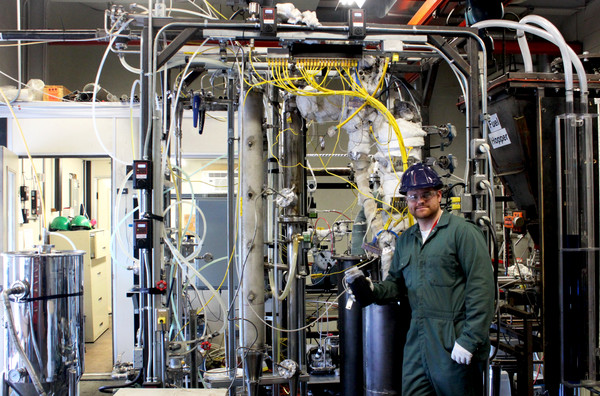
This equipment converts biomass residues (such as forest residues from the paper and pulp industry) into a liquid which has applications as a renewable fuel for heating applications, an intermediate for the production of transportation fuels, or as a source of high-value chemicals. This transformation occurs through a process called fast pyrolysis and thus the liquid product is often referred to as biomass fast pyrolysis oil. Just as each of the different solid biomass residues used as a feedstock has a unique set of properties, so do the biomass fast pyrolysis oils produced. This system allows CanmetENERGY-Ottawa to produce pails of biomass pyrolysis oil for further study determining suitability in various energy and chemical applications.
Field of Study and Institution: Benjamin Bronson, Research Engineer, Bioenergy Systems, CanmetENERGY-Ottawa
Photo credit: Emily Fielden
Finding Chlorine
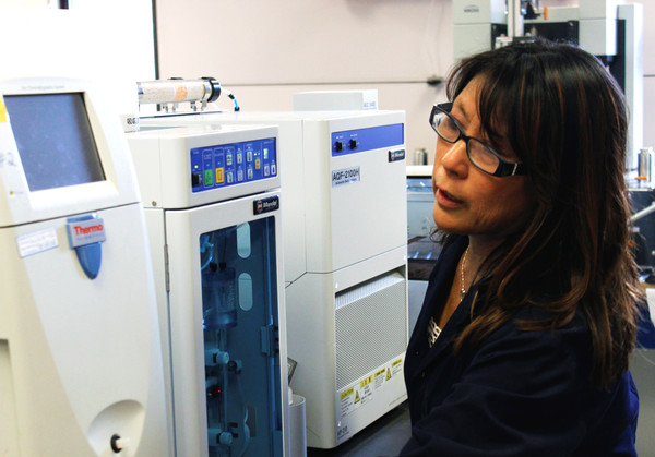
Halogens such as chlorine can cause problems with corrosion and plugging of industrial processes, this can lead to issues in system designs, fuel blends, or negative environmental impacts for Canadians. CanmetENERGY-Ottawa's Characterization Laboratory analyzes a variety of sample matrices using combustion ion chromatography (CIC). Most commonly analysed matrices seen are biomass, coal and combustion residues. However, this method has also been successfully applied to refuse derived fuels (RDF) and catalysts. Here, an analyst is working on the analysis of samples using an automated combustion ion chromatography system.
Field of Study and Institution: Valerie Omatsu-Baas, Characterization Laboratory, CanmetENERGY-Ottawa
Photo credit: Emily Fielden, Business Office, CanmetENERGY-Ottawa
Tent Life
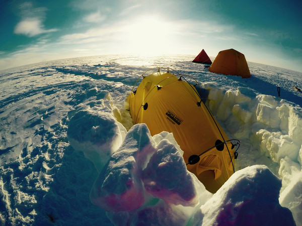
The Agassiz Ice Cap on Ellesmere Island is where the team will call home while ice coring in the North. My yellow tent, tucked neatly in the snow, is where I'll be camped out alongside two of my fellow researchers.
Research/Profile: My name is Dr. Alison Criscitiello, and I am a post-doctoral fellow at the University of Calgary. I drill ice cores, and analyze their chemistry to understand climate in the past.
Photo credit: Alison Criscitiello
Always have an eye out for Polar Bears!
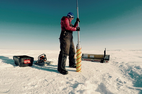
I'm using a Kovacs shallow ice coring drill to extract a core from the summit of Ellesmere Island's Agassiz Ice Cap. The shotgun is for polar bear safety!
We use a special power head that assists ice core scientists in drilling shallow cores.
Photo credit: Alison Criscitiello
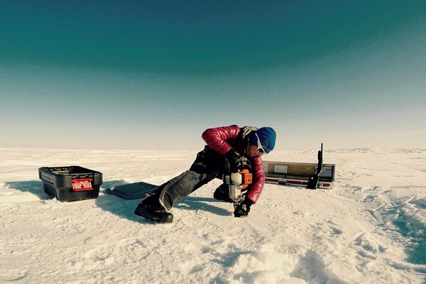
New ice cores, new clues
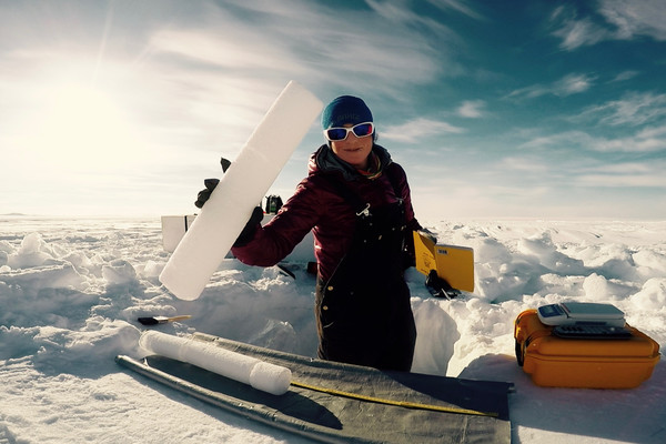
After drilling 10 meters down into the firn (a type of snow), I'm processing the core I just drilled. The question is - What clues are held in its layers?
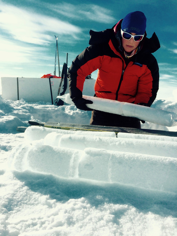
I'm bagging the clean sections of the new Agassiz Ice Cap ice core so that they are ready to ship home to the lab for analysis.
Photo credit: Alison Criscitiello
Red field clothes for surveys on Canada Day (it was pre-planned! #canadanerds #thebirdsdonotknowitisaholiday)
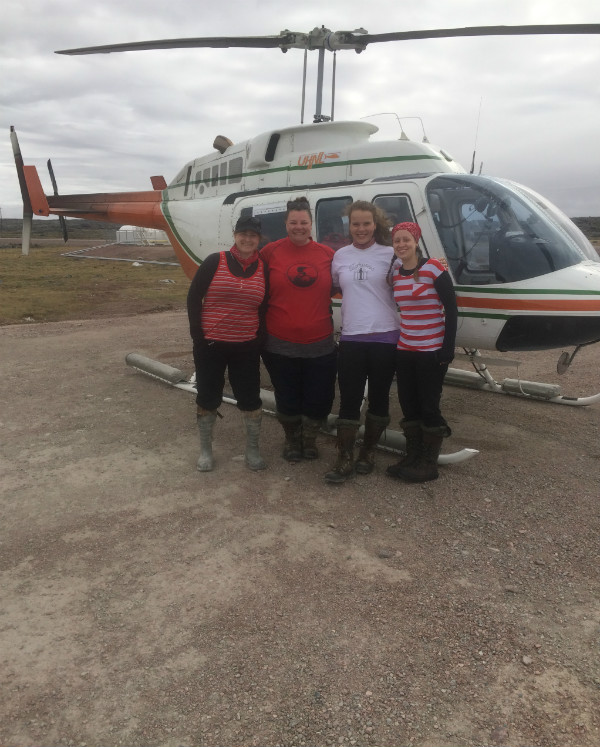
We work on Canada Day every year, so we plan to bring red and white clothes. The true E-tundra story behind this picture is that we were freezing. It was so cold so we stripped down, Gerard (the pilot) snapped the pic and then we all put 3-4 layers overtop, so the birds we study didn't even get to see our Canada Day celebration outfits!
Photo Credit: Gerard Hartery, UHNL
Profile: Jennie Rausch, Shorebird Biologist, Canadian Wildlife Service, Environment Canada
Project: Mainland Nunavut (Ukkusikalik National Park, Naujaat, Kugaaruk, Igloolik) & Nanuit Itillinga (Polar Bear Pass) National Wildlife Area, Bathurst Island, Nunavut . The team is studying densities and habitat preferences of arctic-breeding shorebirds and songbirds. Many species of shorebirds are in population decline, so we are working to discover how many there are, what areas in the arctic are important for their breeding success and what are the factors that are limiting population growth and breeding success. This is an ongoing long-term monitoring program.
Arctic Program for Regional and International Shorebird Monitoring
http://www.seaturtle.org/tracking/index.shtml?project_id=1020
Semipalmated Sandpiper nest, well camouflaged eggs
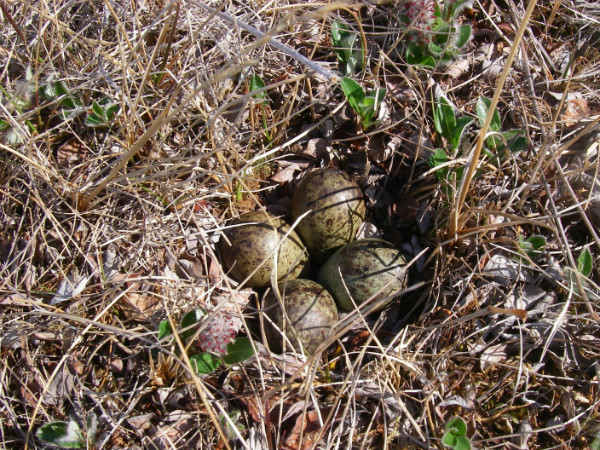
Most shorebird species have eggs that are coloured/speckled to suit the vegetation in the habitat they prefer to nest in so that the nests and eggs blend in extremely well. The nests are nothing fancier than shallow bowls/depressions sometimes lined with leaves or lichen from the surrounding area which also helps with blending in #functionoverform . The eggs are around the size of a toonie.
Photo Credit: Lara Falkiner, CWS
Profile: Jennie Rausch, Shorebird Biologist, Canadian Wildlife Service, Environment Canada
Attack by a nesting jaeger
Coop summer student Lara Falkiner was dive-bombed by a nesting Parasitic Jaeger. As part of their defense mechanism, they will actively and persistently target potential threats while subtly leading the threat away from the nest location. It's hard not to be impressed at their thoroughness, but it still is strange to get 'thwaped' in the back of the head at the same time!
Photo Credit: Jennie Rausch, CWS
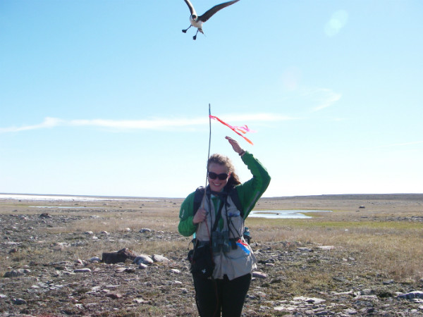
Releasing a Black-bellied Plover fitted with a satellite backpack
Lisa Pirie releasing 'Aupajaangajuq' (Inuktitut for the colour orange because he is sporting an orange leg band). To assist with answering questions such as use of migration stop-over sites along the Atlantic coast, length of stay at stop-over locations, use of protected areas in Canada, and use of wintering locations, we are fitting several Black-bellied Plovers with solar-powered transmitters that are worn like a back pack. The transmitters send location signals to the Argos satellite system every couple of days allowing us to keep tabs on the birds year round. #caribbeanwintersarcticsummers #frequentfliermiles
Photo Credit: Jennie Rausch, CWS
Snowy Owl chicks with lots of lemmings for food
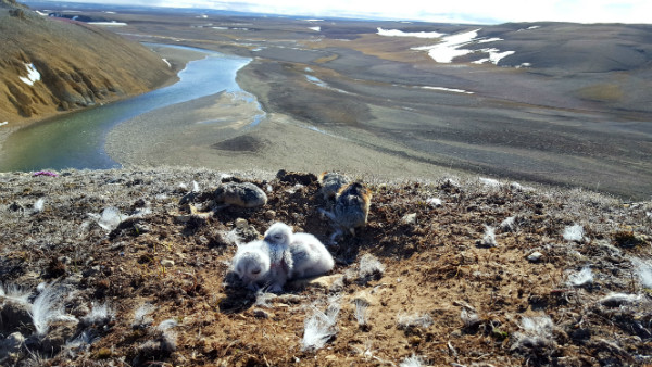
Nanuit Itillinga (Polar Bear Pass) National Wildlife Area provides habitat for many species of nesting birds. Although the focus of our research is shorebirds, our surveys include all bird species that breed on the tundra. Portions of Nanuit Itillinga National Wildlife Area have lush wetlands and others dry uplands that include geological features such as hoodoos and cliffs where this Snowy Owl nest was found. #ifieatanotherlemmingiamgonnahurl #foodcoma
Photo Credit: Kiersten Shulhan, CWS
Profile: Jennie Rausch, Shorebird Biologist, Canadian Wildlife Service, Environment Canada
The remains of a bull muskox killed by a wolf pack on Axel Heiberg Island
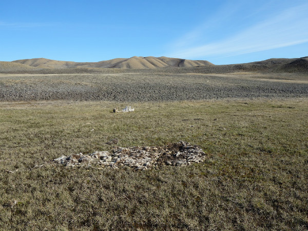
We investigate areas where the collared wolves have spent several hours or days, or revisited frequently. Since wolves are usually on the move, when they stop somewhere for an extended period it's typically because they are on a kill or at a den. If they stop for shorter periods, they may be resting or hunting small game.
Photo Credit: Morgan Anderson
Profile: Morgan Anderson is the Government of Nunavut's regional wildlife biologist for the High Arctic. She is based in Igloolik, but works out of Grise Fiord, Resolute, and points beyond - weather permitting. Her research program is focused on the ecology of Peary caribou and muskoxen in the High Arctic.
Backpacking camp on Axel Heiberg Island
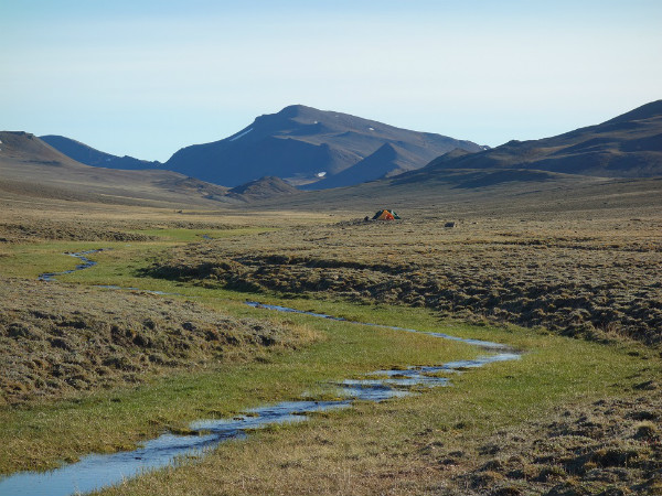
We hike from one wolf location cluster to the next to see what the wolves were doing there. The collar locations can tell us that the collared wolf spent a certain amount of time or made several visits to a location, and combined with activity data collected by the collar, we hope to be able to estimate kill rates remotely - but to do that, we have to visit these cluster locations to determine whether there is a kill and what the wolves have killed. These investigations have also led us to several new den sites that can be checked annually to get pack and pup counts.
Photo Credit: Morgan Anderson
Local knowledge meets western science
The NU Department of Environment uses both local knowledge and western science in decision-making. Keeping communities involved and engaged in research from the planning stages through to interpreting results and deciding on management actions is key to the co-management framework in Nunavut. The weather is often uncooperative, but in-person meetings are definitely preferred - here, a trip to Grise Fiord to catch people before boating season.
Photo Credit: Morgan Anderson
Peary caribou and muskox survey
Digging out a fuel cache at Truelove Lowlands during a Peary caribou and muskox survey on Devon Island. Muskox numbers have nearly quadrupled from historic population estimates on the island, but they are still distributed in the productive lowland habitat patches. Caribou likely remain stable at low densities.
Photo Credit: Morgan Anderson
Wolf pups at the Vesle Fiord den
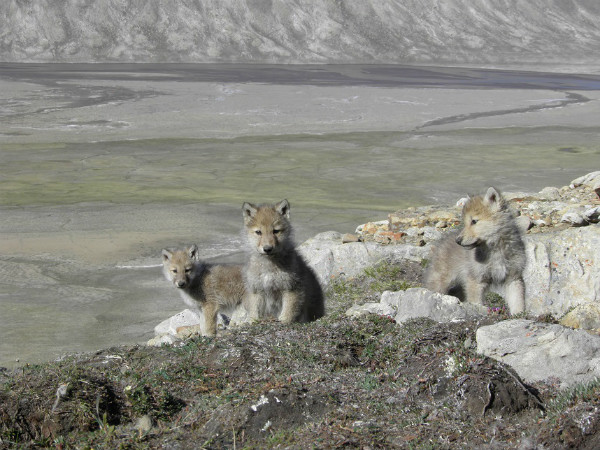
Since wolves concentrate around the dens in early summer, we can get accurate pack counts - the whole pack may not be travelling together at other times. We're also able to get pup counts and often record instances where litters fail early in the summer; this is important information for determining productivity.
Photo Credit: Morgan Anderson
Curious Peary caribou bulls
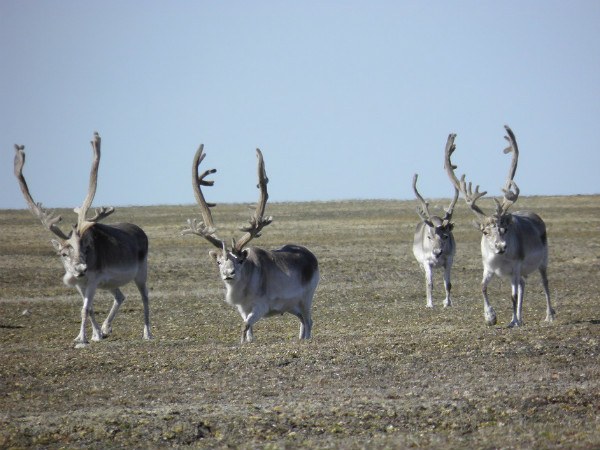
Curious Peary caribou bulls on Bathurst Island approach us while we collect their droppings for genetic work. This project has allowed us to determine population boundaries for caribou without requiring any capture and handling. Where caribou occur at high enough densities, we only require a helicopter for positioning; we then collect samples on foot, which reduces disturbance even more.
Photo Credit: Morgan Anderson
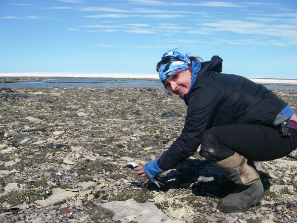
Colleen and Caroline - a double on tundra.
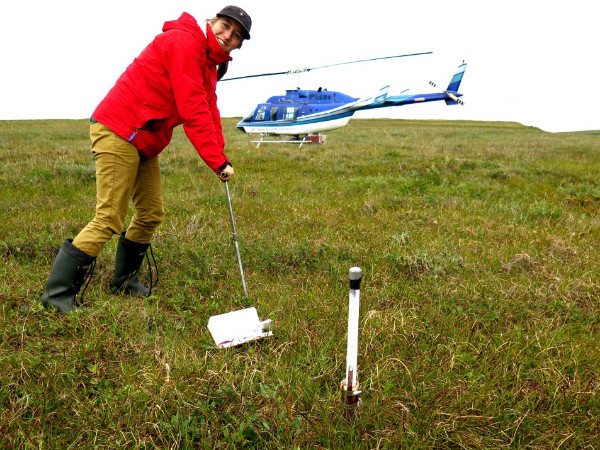
Photo 1: Soil sampling at one of many thaw tube sites around Inuvik, Mackenzie River delta, and Richard's Island. Thaw tube measurements can tell us about maximum thaw depth and ground movement.
Photo by: Caroline Duchesne
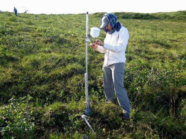
Photo 2: Air temperatures are also collected at most sites. These instruments can be a chew-toy for animals, and occasionally require some TLC. This instrument is in a patch of cloudberries, which are perfect for a quick field snack.
Photo by: Colleen Fish
Profile: Colleen Fish, University of Victoria, RAP student and Caroline Duchesne, Geological Survey of Canada, Physical Scientist