
Great Lakes 2 km Physics Analysis and Forecast Updated Every 12 hrs
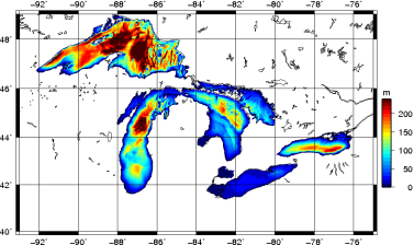
Bathymetry of the Great Lakes
Overview:
The Water Cycle Prediction System Coupled over the Great Lakes (WCPS-CGL) provides analyses and 84 hr forecasts of atmospheric, ice and ocean conditions over the Great Lakes every 12 hrs. The atmospheric model uses a 10 km resolution grid while the ice-ocean model uses a 2 km resolution grid. WCPS-CGSL is initialized using atmospheric analyses from the 10 km resolution Water Cycle Prediction System together with ice and ocean analyses produced using a data assimilation system that combines model estimates with RADARSAT image analyses produced by the Canadian Ice Service.
Ice and ocean forecast and analysis products from WCPS-CGL:
- Lake level anomaly (m)
- water temperature (°C)
- currents (m/s)
- sea ice fraction (%)
- snow depth on sea ice (m)
- ice thickness (m)
- ice drift velocity (m/s)
- ice pressure (N/m)
Geographical Coverage: Lake Superior, Lake Michigan, Lake Huron, Lake St. Clair, Lake Erie and Lake Ontario
Spatial Resolution: 2 km
Vertical Coverage: 35 levels, ranging from 1 m at the surface to 140 m thickness at depth
Temporal Resolution: Daily mean for all fields, and hourly averaged surface fields
Temporal Coverage: From October 28, 2014 to present
Documentation: available upon request.