
Welcome to the 2016 Canada-Sweden Polar Expedition blog!
Blog posts recount the important scientific research taking place aboard the CCGS Louis S. St-Laurent, as well as everyday life onboard a Canadian Coast Guard icebreaker during the 2016 Canada-Sweden Polar Expedition.
Canadian scientists are collecting data in support of Canada's extended continental shelf submission to the United Nations Convention on the Law of the Sea (UNCLOS). The scientific survey ran from August 5 to September 18, 2016.
Table of Contents
- Meet Émilie Hébert-Houle, Teacher at Sea!
- Ye good olde sea sickness
- Rendezvous with the Swedish Icebreaker Oden – Why a two-vessel expedition?
- The CCGS Louis S. St-Laurent research programs
- Weekend divided between the helicopter, polar bears and the rosette
- Raffi Kuyumjian – From Space Ships to Icebreakers
- North Pole Frenzy
- Sailing away from the top of the world – back to 24/7 operations!
- Lab tour: Geophysical laboratories
- Lab tour: Ice observation office
- Lab tour: Oceanography laboratories
- Down at the bottom of the deep blue sea...
- Lab tour: Hydrography laboratory
- Sailing the Arctic Ocean
- The Arctic Ocean
- End of the 2016 Canada–Sweden Polar Expedition
Meet Émilie Hébert-Houle, Teacher at Sea!
 My name is Émilie Hébert-Houle, and I was hired as a Teacher at Sea to take part in the last, but not least, expedition of Canada's Extende d Continental Shelf Program to map the extended continental shelf in the Arctic Ocean.
Under the United Nations Convention on the Law of the Sea (UNCLOS), which Canada ratified in 2003, we have an obligation to define the outer limits of Canada’s continental shelf. In 2013, Canada submitted the coordinates for the outer limits for the Atlantic Ocean, and now we’re undertaking the final survey to map the Arctic Ocean.
Over the next 47 days, my role as Teacher at Sea will be to share with Canadians the important scientific research taking place on the CCGS Louis S. St-Laurent and the Oden, the Swedish icebreaker joining us, as well as to describe everyday life onboard a Canadian Coast Guard icebreaker -- quite a fascinating prospect for me, since I’ll be boarding such a vessel for the first time!
This expedition will actually mark my second visit to the polar regions. In 2009, I participated in a university expedition to Antarctica with Students on Ice (SOI), a foundation with the mandate to educate youth about the polar regions. It is through the SOI family that I learned about this wonderful Teacher at Sea opportunity and was selected for it.
My background is in environmental sciences and physical geography. Since 2009, I have travelled and lived in Nunavik intermittently for work, studies and research. Thanks to the Centre for Northern Studies and the Kativik School Board, I have spent a lot of time on Inuit land, taking part in various environmental and social research projects and teaching physical education and environmental science. I have also been a naturalist at Explos-Nature, a Quebec North Shore organization specializing in marine biology youth camps. I’m currently a graduate student at the Université du Québec, studying environmental research outreach projects for the general public, especially in Indigenous contexts.
Armed with all these experiences, I welcome this opportunity to do what I love the most, which is to keep learning how to better understand our environment and to transmit this knowledge to young and old!
I hope to capture your attention for the next 47 days and share this unique experience as we sail in the Arctic Ocean. I’m already onboard, docked at the port of Tromsø, in Norway. I’ve met the ship’s crew and the scientific team, and I’m already learning about the many research projects that will take place: they’re fascinating and making my fingers twitch! I can’t wait to share their stories!
Feel free to send me your questions. They’ll be forwarded to me on the CCGS Louis S. St-Laurent, and I’ll try my best to incorporate the answers in my blogs. You can also find me on Twitter @emiliehchoue
See you soon ;)
Émilie

Ye good olde sea sickness
The CCGS Louis S. St-Laurent’s stop in Norway allowed us to sample Tromsø’s charms. The crew and scientific team members set out on foot, by bus or taxi to visit the downtown area and its boutiques and cafés, as well as the nearby shopping centres, tourist attractions, cable cars, churches and museums, while taking in the spectacular local architecture.
Monday was our last chance to stretch our legs on land, use the Internet and enjoy a good cup of espresso. So, for the last time before our seven-week sea journey, the ship was empty, but everybody came back at 4 pm to prepare for our departure at 6 pm.
We cast off from the dock at 6 pm sharp without much ceremony other than the sound of the ship’s horn. Many jellyfish floating lazily on top of the water were churned up by the ship’s wake when we got underway while the sailors and scientists stood on the bridge armed with cell phones and all manner of cameras. The first hour flew by! Under a cloudy sky with clear patches, everyone admired the majesty of the fjord, cliffs, mountains and glaciers as the small villages and farms at the water’s edge passed softly by.
At about 11 pm, the last holdouts on the bridge saw a most impressive sunset as we left Norway and reached the high seas. The sun had stayed hidden for a few hours on the horizon and now it became visible through the clouds as the wind intensified and the waves climbed higher.
At 3:00 am, we penetrated a weather depression system and, even though we stayed on the outside edges of it, it was just enough to wake almost everyone on board. After the big waves literally lifted people off their mattresses, the researchers wanted to get up to appease their consciences and ensure that their materials were secure everywhere and not tumbling in the laboratory. Personally, I didn’t sleep for the rest of the night because of the ship’s movements and noises. Once it was morning, when I tried to get up, I realized that I was suffering from sea sickness so I stayed in bed! Lunch tempted me to get up, as I was feeling better. The Fisheries and Oceans Canada team from the Institute of Ocean Sciences in British Columbia taught me the protocol for collecting micro-plastics in sea water, which is my mission during the expedition (details will be provided in another post). After this collection session, my seasickness returned with a vengeance, so I headed back to my bed. I stayed there until dinner time and the scenario was similar in the evening. In summary, I spent my first wonderful day at sea “horizontal.”
You might be imagining a big storm from my description. That wasn’t the case. Poor weather is not exceptional; it is typical of the North Atlantic. Winds were between 30 and 45 knots and the waves reached several feet high. “It’s really bad at the core of the depression to the east. You can go and see it if you want to,” suggested the officers. “Really,” I said. “How about later?” Not for the faint of heart, the good old CCGS Louis S. St-Laurent rolled between the waves, testing both new people and old hands on this Tuesday, August 9, 2016.
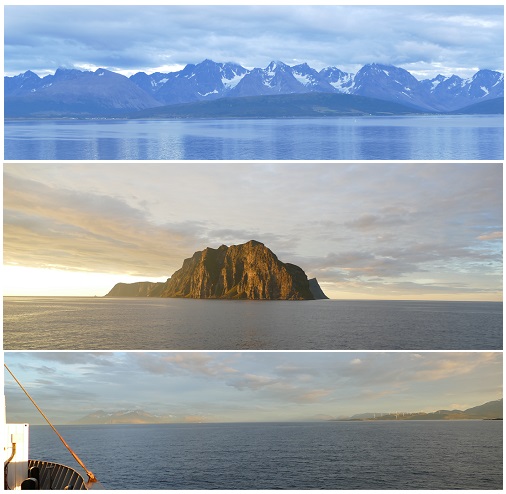
Top : Lenangsbrenn and Strupbrenn. Middle: Nord-Fugløya island. Bottom: Storgalten, Tverrbakktind, Gamvikblåisen and Vannøya island.
Next post: We meet up with the Swedes and their ice-breaker, the Oden
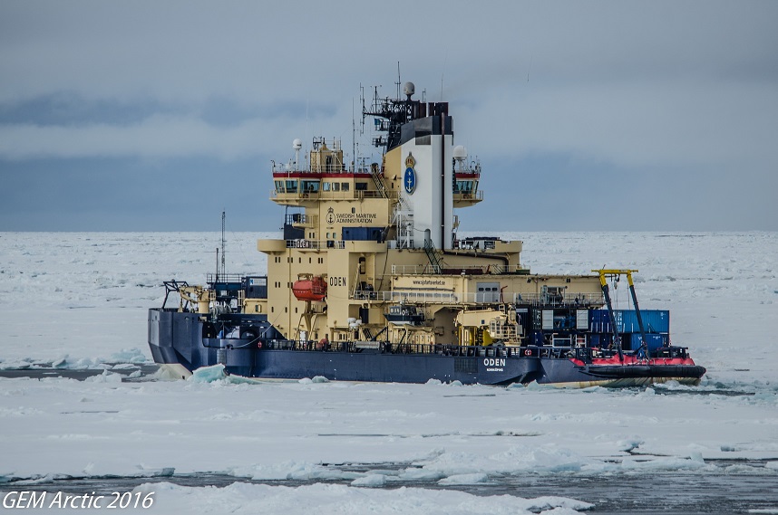
Rendezvous with the Swedish Icebreaker Oden – Why a two-vessel expedition?
Our third day at sea was a busy one. In the midst of instrument tests and measurements, we joined the Swedish Icebreaker Oden in the pack ice. The Oden’s helicopter, which was on board CCGS Louis S. St-Laurent (CCGS LSSL) since Tromsø, flew back to the Oden with the Swedish helicopter engineer and pilot.
You might wonder why a Canadian Icebreaker is heading deep into the Arctic Ocean with a Swedish Icebreaker. The truth is, a second icebreaker is needed for our expedition. The Oden will be providing icebreaking support to the CCGS LSSL by making a wide path through the ice so we can safely tow our scientific instruments. Together, the two heavy-duty icebreakers will be able to get through the thickest ice in support of the research we need to undertake.
Apart from breaking ice, there are many advantages in having two vessels on a polar expedition.
First: Safety matters. You don’t want to be alone in the ice in an emergency. Help is far away: it can take many days for a ship to reach you.
Second: Travelling with two ships allows us to go into areas where one ship could not go alone. Two ships can alternate their activities to work in very remote areas where there is thick, multiyear ice.
Third: Each ship brings different capabilities to the project, and we benefit from each other’s special assets. For example, we are happy to have the Oden’s back deck, which is like a huge pick-up truck. This feature makes the deep dredging of rocks and the coring of sediments easier. These sediments and rocks contain valuable data for our scientists reviewing Canada’s UNCLOS submission as they may help confirm Canada’s geological story. At times, the Oden will also be measuring geophysical waves refracted from the subsoil below the seafloor.
Fourth: Working together, we can conduct more research and increase the general understanding of the Arctic Ocean. The Oden leads its own scientific program, which is complementary to Canada’s and increases the scientific data collected during the expedition.
As Mary-Lynn Dickson, chief scientist of the expedition, puts it: “The Arctic Ocean is the world’s smallest ocean, but it is certainly the least studied.” International partnerships foster scientific collaboration, helping us understand the unprecedented changes occurring in the Arctic Ocean.
As we continue on with the expedition, we must make the most of this endeavour and gather as much scientific data as possible. Getting to the Arctic Ocean is difficult and requires a great deal of planning. Arrangements and planning for this year’s survey have been underway since 2014!
So here we are, the two ships finally united in the Arctic waters, ready to undertake great scientific and human endeavours. And to think that we get to explore Canada’s outer edges as the countdown for Canada150 celebrations begins… What an incredible feeling!
The CCGS Louis S. St-Laurent research programs
August 12 was our first full day of sailing through the ice. Since the ice is not as tightly packed right now, we made slow but steady progress, with both ships being stuck in the ice a few times. In any case, the fine snow that began to fall at the end of the day told us summer was well and truly over. :)
In this entry, I’ll explain in greater detail the research program being conducted aboard the Canadian Coast Guard Ship Louis S. St-Laurent (CCGS LSSL). It may be a dry topic for a blog post, but before I go on to tell you what’s happening on board, it’s important to take the time to fully understand the differences between the work of the three scientific groups. These groups are separate yet complementary, and it’s very easy to get them mixed up.
This year, the scientific team aboard the CCGS LSSL has 24 members drawn from three departments of the Government of Canada (Figure 1). Each of the three groups has a specific mission. The geophysics and bathymetry groups are gathering vital data to complete Canada’s submission to the United Nations Commission on the Limits of the Continental Shelf (UNCLOS), while the oceanography subgroup is collecting oceanographic data on water masses and currents in the Arctic Ocean.
The Geological Survey of Canada (Natural Resources Canada) is studying the geological layers of the seafloor, the Canadian Hydrographic Service (Fisher ies and Oceans Canada) is mapping the shape of the seafloor, and the Institute of Ocean Sciences (Fisheries and Oceans Canada), is trying to improve our understanding of oceanography in the Arctic Ocean. The table below describes the research objective of each team, the main instruments they are using to gather data, and how those instruments are used.
| NRCan – CCG | DFO – CHS | DFO – IOS | |
|---|---|---|---|
| Objective | Determine the composition and depth of the sediment layer in order to define the limits of the extended continental shelf | Measure the depth of the ocean and determine the shape of the seafloor in order to define the limits of the extended continental shelf | Gather oceanographic data to track the movement of water masses from the Pacific and Atlantic Oceans in the Arctic Ocean |
| Instruments |
Sound sources (very low frequencies) Sound receivers (200-m cable towed behind the ship) |
Sonar (high frequency) |
Rosette (CTD) Deployable probe (XCTD) Surface water samples |
| Methods |
|
|
CTD
XCTD
Surface water samples
|
| Needed for UNCLOS? | Yes | Yes | No, but of great scientific importance to increase our knowledge of the Arctic Ocean |
Figure 1 Missions of the research team groups aboard CCGS LSSL
This multidisciplinary team has been working together since the program was launched in 2006. Each group is in charge of performing specific tasks that are essential to achieving the overall scientific mission overseen by Mary-Lynn Dickson. Aboard the ship, Mary-Lynn’s role is to coordinate the specific objectives and work with Captain Anthony Potts, the Hydrographer-In-Charge Paola Travaglini and all the scientists onboard to ensure the general mission is completed during the six weeks at sea.
So did you get all that? Tomorrow I’ll show you where they work on board, as each of them has their own quarters in different parts of the ship. Now I’m off to the yoga class I’m teaching here--the first in a series of 10 aboard the CCGS LSSL!
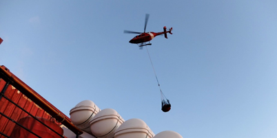
Weekend divided between the helicopter, polar bears and the rosette
Our first weekend on board the CCGS Louis S. St-Laurent (LSSL) was spent sailing toward our mapping sites. Since our departure, the hydrographers have been amassing data continuously and the oceanographers have been taking weekly measurements using deployable probes and collecting surface water samples. During this time, the geophysical team has been busy making the necessary preparations before the official start of survey operations aimed at detecting geological layers. The rest of the crew are busy at their stations, from the lower decks to the bridge, to keep us on course and look after our needs, including ensuring that we’re properly fed!
The LSSL’s helicopter made its first sortie and took advantage of a scientific activity being conducted by the crew of the Oden on the pack ice to fly over to our companion vessel and pick up visitors! Thomas, a German geophysicist who sailed on the LSSL last year, and Per, a Swedish geologist, came over to coordinate science operations between our two vessels. I can certainly tell you that seeing new faces in the middle of the Arctic Ocean has quite an impact, even when you’ve only been at sea for a few days… life on a ship like this makes you realize that we humans are a gregarious species :)
While the first few evenings seemed long and solitary, the second and third mates organized a few social activities, and we are enjoying each other’s company! I also saw my very first polar bear, a wonderful specimen, a juvenile according to the Inuit marine mammal observers onboard.What strength, what agility and what a privilege it is to be able to observe them in their natural habitat. During a previous expedition, the crew saw 22 polar bears in a single day…. However, I must point out that they were closer to the mainland. Out here, it is only the curious young bears who approach for a closer look. “Mature bears are too smart to venture so far from shore …,” said Nelson Ruben (marine mammal observer).
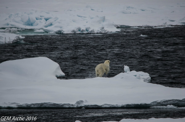
Our very first polar bear sighting!
The weekend ended with the deployment of a water sampling rosette. The instrument began its descent at 00:30 am, reaching a final depth of 4,342 metres! Two oceanographers and a few crew members kept watch until 04:00 am, when the rosette was recovered and brought on deck. The oceanographers then transferred all the seawater samples to containers for storage before ending their shift at 05:30 am.
Deployment of a water sampling rosette
In future blogs, I will explain what a rosette is and how it works. I am fascinated by this device and can’t stop talking about it! Stay tuned!
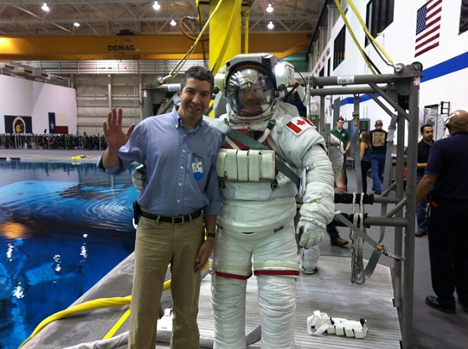
Raffi Kuyumjian – From Space Ships to Icebreakers
Guest contribution by Raffi Kuyumjian, 2016 Canada–Sweden Arctic expedition CCGS Louis S. St-Laurent ship doctor
As a kid, I was always fascinated and inspired by exploration and space. I read stories about Amundsen, Cousteau, Hillary, Armstrong, Picard and many others. I was born after the first landing on the moon, so I have no memories of the moon landings as they happened in the early seventies. However, I do remember seeing pictures of Earth from space, taken from the far side of the moon (the Earthrise), reading about Tintin going to the Moon, watching Star Trek and Space 1999 on TV… dreaming of becoming an astronaut and going to space some day!

At the National Aeronautics and Space Administration (NASA) Mission Control Centre
My name is Raffi Kuyumjian, and I’m the ship’s doctor on the CCGS Louis S. St-Laurent for the 2016 Canada–Sweden Arctic expedition. My educational background is in engineering and medicine. My early years of medical practice were in family and emergency medicine in remote and isolated communities on the lower North Shore region of Quebec. For over a decade, I have been working in the field of space medicine, specifically as a flight surgeon at the European Space Agency (ESA) and at the Canadian Space Agency (CSA).
A flight surgeon is a medical doctor who is responsible for the medical care of aviators and astronauts. The term that is used is historical and comes from the early days of aviation; flight surgeons are not even necessarily surgeons nowadays.
In school, I did well in math and sciences, so I was drawn to engineering and eventually medicine. During my medical studies, I found out rather by chance about a discipline called space medicine and an opportunity for medical students to do a one-month elective at NASA’s Kennedy Space Center (KSC) in Cape Canaveral, Florida. I thought, What a great opportunity! The space program seemed to me like the perfect place to put both my medical and technical background to use.
With Canadian Astronaut Chris Hadfield
After a year of going through several challenges, one being that NASA accepted only U.S. citizens, I was fortunate to be accepted to the program. When I arrived at KSC, I felt like a kid in a candy store: this is where NASA’s rockets and space shuttles were launched from, including the rockets that went to the moon! I would not have imagined back then that I would one day be working for the space program. It seemed so inaccessible, especially for a Canadian. But sometimes, good fortune and luck can help, and several years after that, I moved to Cologne, Germany, to work for ESA.
I got my first assignment as a flight surgeon at ESA in 2006, where I was to provide medical support for the first Swedish astronaut, Christer Fuglesang, who would be flying on the STS-116 Space Shuttle flight. I have very fond memories of that mission, as there were many firsts for me. These included witnessing my first shuttle launch -- a very powerful event in every sense of the word -- the first time I worked at the Mission Control Center in Houston (and, no, there were no problems!) and the first landing and recovery of the crew at KSC.
What a great opportunity and fortune, a decade later, to work as a physician on board a Canadian Coast Guard vessel taking part in a Canadian–Swedish Arctic scientific expedition! The remoteness, isolation and extreme environment aspects of this expedition are not unlike those of astronauts living and working on the International Space Station today.

At the North Pole on August 21, 2016
North Pole Frenzy
I have come to know that planning a tight schedule is nearly impossible on a ship. As for planning for events in the North, it can all be out the window in a second if something happens in the community. The same can be said about science fieldwork: you may have solid plan, but if it is foggy, the helicopter will not fly.
Since we are on a ship, in the North, doing science fieldwork, let me tell you that your “adaptation switch” had better be turned ON. You can be on hold, waiting and waiting, and then suddenly be rushed because it is happening NOW!
This is how we approached our arrival at the North Pole -- because no amount of planning could guarantee when we’d actually arrive, speculations were widespread! In the end, it turned out that instead of being delayed, we were to get there early! We rushed to decorate our Styrofoam cups, our town signpost arrows, and all the other little ideas and gifts we had in mind for ourselves, our friends and family. Many people onboard had set foot on the North Pole before, so they were experienced in preparing for the big event. As a first timer, I was kind of nervous!
Sunday finally came. By mid-morning, calls on the pipe -- the ship’s intercom -- were announcing “One hour to the North Pole,” then “30 minutes to the North Pole” and finally “We’re at the top of the world!” as the ship’s horn blasted to announce our arrival. As we sailed three times around the world to find hard ice, the decks filled with colourful and joyful people dressed for the occasion, showing off their national, provincial or town pride and carrying their little arrows around! To kick up the excitement even more, a new passenger started roaming around the ship … Santa himself!
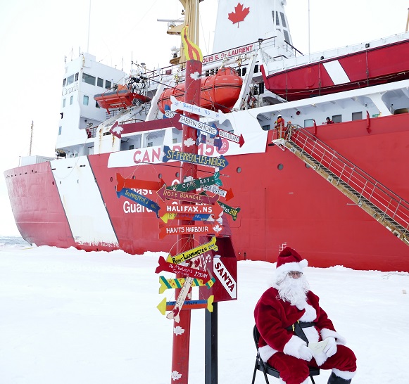
People were greeted at the North Pole by Santa Claus and his mailbox
After lunch, the Oden started letting people out onto the ice. The CCGS Louis S. St-Laurent was wedged against an ice floe a few hundred metres behind the Oden. Our crew stepped onto the ice shortly after.
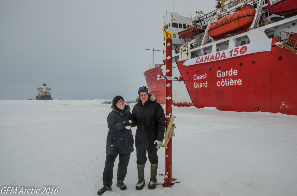
Canada-Sweden Polar Expedition Chief Scientist Mary-Lynn Dickson (NRCan) and CCGS Louis S. St-Laurent Captain Anthony Potts exchange warm handshake at the icy North Pole
People were greeted at the North Pole (an actual pole is set up on the ice) by Santa Claus and his mailbox. The designated area was busy with people taking pictures and doing fun things, as the Canada 150 banner was hung from the side of the ship to celebrate the countdown to Canada’s 150th anniversary of Confederation.

The CCGS Louis S. St-Laurent celebrates Canada's 150th anniversary of Confederation at the North Pole
Different groups gathered under the banner and immortalized their passage to the top of the world with lots of pictures with a grey sky, white snow and a chilly wind reddening our cheeks!
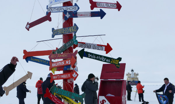
The arrows we decorated with our town name and its distance from the North Pole
And to make it official, I got a North Pole stamp and my certificate -- proof that I was at the North Pole! :)
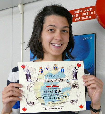
I got my certificate – proof that I was at the North Pole!
Sailing away from the top of the world – back to 24/7 operations!
Canada’s Extended Continental Shelf Program has been mapping the ocean since 2006. Since then, a massive amount of geophysical and bathymetric data has been collected and processed to delineate the outer limits of Canada’s extended continental shelves in the Atlantic and Arctic Oceans.
All this work is necessary in order to prepare Canada’s submissions to the United Nations Commission on the Limits of the Continental Shelf (UNCLOS). The submission for the Atlantic Ocean was made in 2013, and a future submission is being prepared for the Arctic Ocean.
In a previous blog, I covered the research program aboard the CCGS Louis S. St-Laurent (LSSL). Today’s entry begins a series of blogs describing the laboratories and other areas aboard ship where the science is happening.
Starting today, I will spend a day with every team on board and report on their research. It’s a breathtaking scientific enterprise. Many of the scientists onboard have been involved since the beginning. Imagine how much time they’ve spent in those laboratories since 2006! Imagine how much data has been collected and taken back to land to be processed and analyzed! Spending time in their laboratories is needed to fully understand their work, so I will do my best to make you feel like you are there.
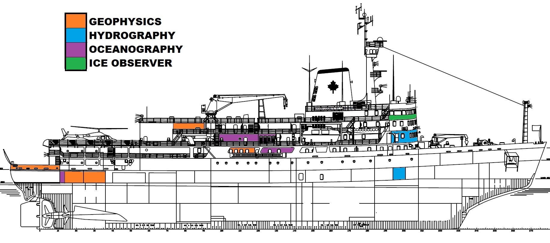
This profile of the LSSL will give you a good idea of the areas of the ship where the science takes place. The colours represent the three scientific fields being studied on board, as well as the Ice Observer, whose scientific expertise is essential to the mission.
***
Life at sea update
Onboard, morale is very good as we sail away from the top of the world. The 24/7 operations restarted soon after the celebrations, and we have retaken our place behind the Swedish Icebreaker Oden after breaking the ice to reach the North Pole. The ship is moving at 3.5 knots so that we can tow the geophysical gear behind the vessel.
Yesterday, everybody had cause for celebration. A Taurus seismometer -- used to measure the refraction, or bending, of sound waves as they move through different layers of the Earth’s crust below the ocean -- had been set up on the ice a week ago. As well as recording data, the instrument emails its geographic position to the ship every three hours -- an absolute necessity, since the ice is constantly drifting. In fact, the ice on which the instrument was placed drifted about 40 km away in just a few days! Even with the GPS technology, a location can be hard to find in the Arctic: the first flight to spot the instrument failed. But we finally located it yesterday. Finding a little black dot in the middle of nowhere is like looking for a needle in a snow bank, and on a ship in the middle of the Arctic Ocean, every data point counts!
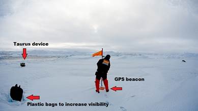
Figure 1 Researcher John Shimeld recovering the Taurus station.

Figure 2 The Taurus ice drift journey. Map by Walli Rainey.
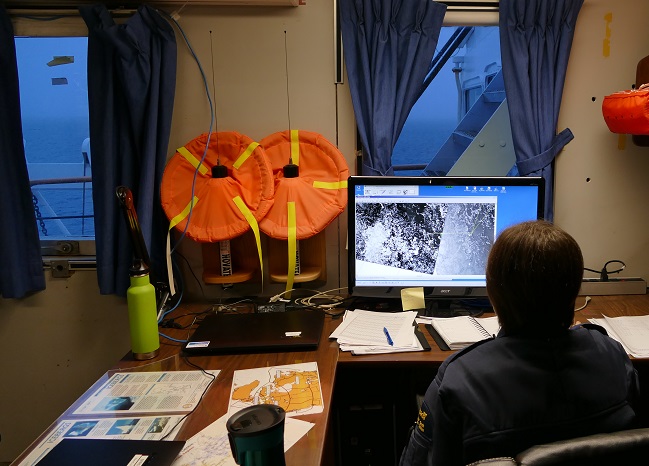
Lab tour: Geophysical laboratories
I’ve gotten my sea legs now. So even if the ship is rolling, I can enjoy myself in the forward lounge writing this blog, watching the sun rise above the ocean. (The closer you are to the bow or stern the more the ship moves.) A delightful moment, my friends, because after the never-ending days, let me tell you, the return of the sun’s rhythm is moving! In this blog, let’s go through the geophysical installations on the CCGS Louis S. St-Laurent.
The Canadian Hydrographic Service is responsible for providing bathymetric data to determine the shape of the seafloor. Its scientific partner in the Canadian UNCLOS Program is the Geological Survey of Canada (GSC), part of Natural Resources Canada. The GSC is responsible for making high-resolution geophysical images of the composition of the seafloor and the subsoil beneath it. Bathymetric and geophysical data are essential to Canada’s submission to the United Nations Convention on the Law of the Sea.
In 2006, when the Canadian UNCLOS program was launched, the GSC team at the Bedford Institute of Oceanography in Dartmouth, Nova Scotia, was tasked with designing and building equipment for the CCGS Louis S. St-Laurent that could withstand being towed under thick ice in the Arctic Ocean. The equipment also needed to be able to send acoustic signals through thousands of metres of water below a moving ship into thousands of metres of sediment and then send the data back to computers on the ship. At the time, very few attempts had been made to do this type of scientific research in ice-covered waters, and it wasn’t possible to buy the equipment off the shelf -- it had to all be designed, built and tested.
Under the expertise of Borden Chapman and his Geoforce Team, the Louis has been transformed into a floating geophysical research laboratory. Over the past 10 years, improvements and adjustments have been constantly made to the setup. Let’s tour the installations.
The Geoforce Team
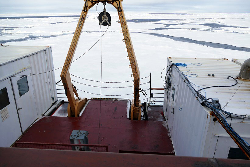
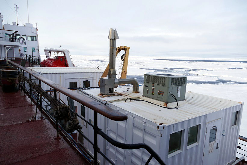
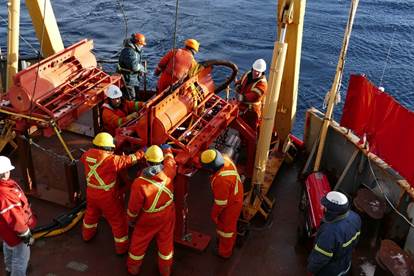
500 level deck: Aft deck and geophysical lab
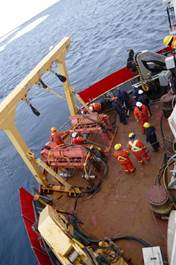
The aft deck: the A shaft, the gun sled, the air pressure control panel and streamers
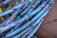
Close up of the streamer
The stern of the ship has had a facelift to become what it is today and safely tow the geophysical equipment behind the ship.
An A-frame installed in 2008 allows the equipment to be towed behind the ship approximately 11 metres below water. Two sleds sit under the A-frame on stands, and streamers that measure acoustic reflections from the sediments are stored on large reels on the aft deck. An air distribution panel in a heated cabinet on port side controls the air pressure sent to each gun on the sled. Sediment reflection data is used to make high-resolution images of the sediment below the seafloor. When combined with sediment refraction data, scientists are able to measure the thickness of the sediments and determine their composition. Both types of data are necessary to define the outer limits of the extended continental shelf in the Arctic Ocean.
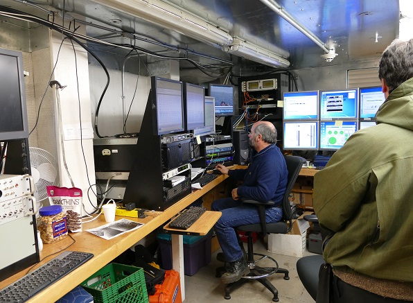
The geophysical lab
Inside, behind the deck, is the geophysical laboratory. This small space is the control centre for the scientific research being undertaken. Here you will find computers displaying real-time geophysical data and data that is collected as the ship moves through the ice. Computers are used to store the incoming data so it can be analyzed once the scientists are back at the Bedford Institute of Oceanography. Computers also display and record the ship’s navigation data so the team knows where the ship is along a survey line, as well as refraction data sent to the ship from sonobuoys that the team deploys. In the lab, monitors display live video streams of the ship’s bow and stern so personnel can better monitor ice conditions when towing the equipment.
400 level deck: The boardroom
In the middle of the ship, on the 400 level upper deck are two rooms with long tables and more computers. The port-side room is the boardroom, where work desks are set up. This is the work space for Wally, an UNCLOS program GIS specialist and database manager; Kai, a research assistant in the GSC; Ken, a foreign affairs officer with Global Affairs Canada; and myself, teacher at sea! Science meetings happen here to discuss research plans update people about the survey. Many science matters are discussed in this room at any time of the day.
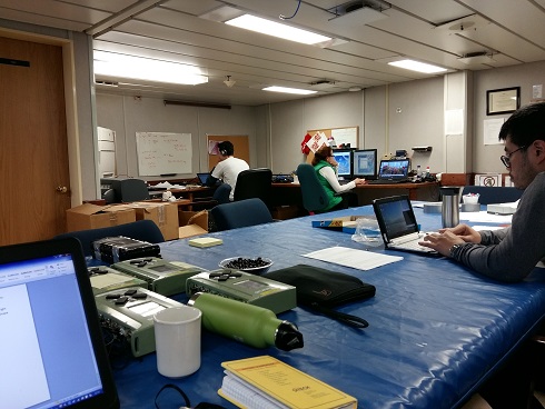
The boardroom
300 level deck
John, a geophysicist with the GSC, processes the geophysical data recorded every day in his cabin on the 300 level. He makes sure there are no problems with data quality and advises the chief scientist on the geophysical data collection so that survey objectives are met.
200 level deck
Two very large pieces of equipment are located on the port and starboard sides of the 200 level deck: the air compressors. One air compressor container was installed in 2006 and the second one in 2010. When geophysical data is being collected, a technician stands watch in the container producing the compressed air. This is where the compressed air necessary to shoot acoustic waves through the water column and the sediments to the bedrock and back up is generated. Approximately 2,000 PSI is required for each shot. By way of comparison, atmospheric air pressure is 14 PSI, inflated car tires are 30 to 40 PSI, and a scuba diving tank is 4,000 PSI. So it’s as if you released half a scuba tank for one acoustic shot.
There is also a container on board that serves as a mechanical and carpenter workshop for all geophysical team needs, such as when repairs have to be done.
View of compressor container from 300 deck

Front view of the working compressor
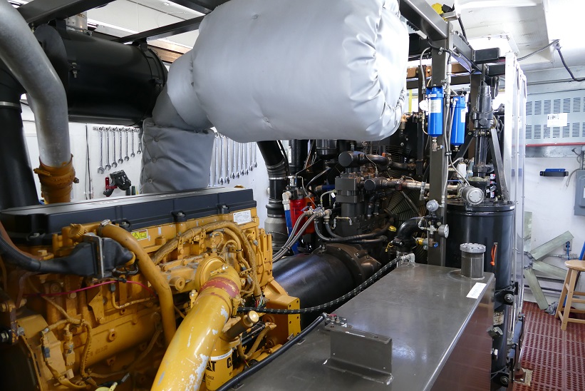
Diesel engine
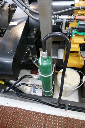
Air compressed container waiting to be released
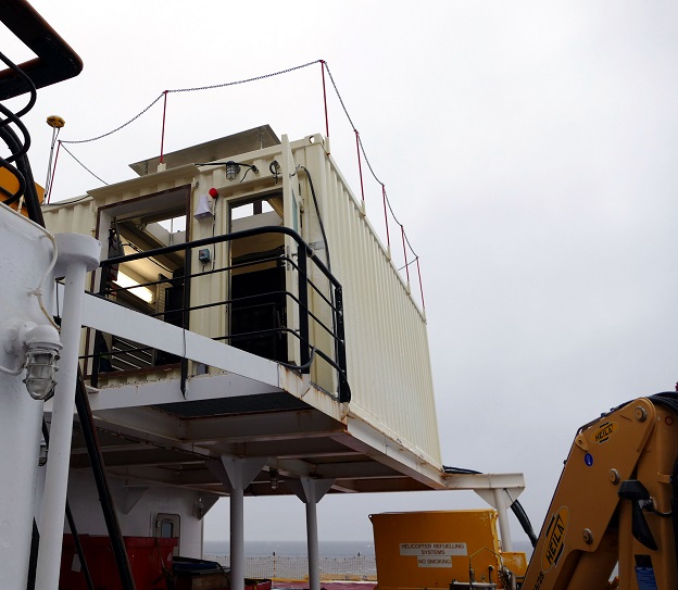
On top of the bridge of the Louis, near the front of the ship, an important structure houses the marine mammal observers. Geophysical measurements cannot be made unless the observer gives the all-clear that no marine mammals are within a kilometre of the ship. If a marine mammal is spotted during operations, the observer radios the geophysical lab, and operations are stopped until the mammal is out of the area. Luckily, the Louis is operating in such remote areas far away from the coast that marine mammals are rarely seen.
All this impressive gear, which has taken years to perfect, will remain with the GSC after the UNCLOS survey is over and be ready to use on future research projects. More importantly, the people who operate this equipment are the reason that Canada’s UNCLOS Program has been able to collect exceptional geophysical data in one of the harshest environments on Earth.
Lab tour: Ice observation office

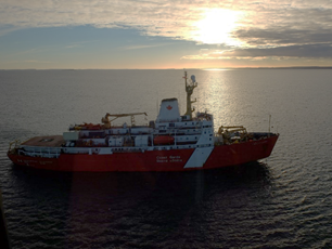
CCGS Louis S. St-Laurent taken from the Oden
Sea ice is omnipresent in the Arctic Ocean. It is a great navigation challenge, even for big ice breakers like the CCGS Louis S. St-Laurent or the Oden. An expedition like this one respects the ice conditions as there is a lot at stake -- safety, time and money -- for the type of scientific work the UNCLOS program requires. When ice is too thick, you get stuck, it consumes a lot of fuel, the gear is at risk, and the data you collect is of lower quality. Therefore, specialists like Erin Clark are hired. Trained by the Canadian Ice Service (CIS), ice observers are onboard to inform the science team and the navigation crew of the weather and ice conditions in the area to help decision-making.
Erin Clark, Ice Services Specialist from the Canadian Ice Service
Ice office
From her office next to the bridge, Erin downloads satellite images provided by her team in Ottawa as well as charts and ice forecasts for the Arctic Ocean. Their work is complementary, as she confirms or improves their analysis, from what she can see from the ship or her helicopter ice reconnaissance surveys. What we call “ground truthing.”
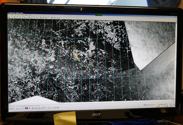
Radarsat-2 satellite image showing the ice around the ship.
From the information Erin gathers from remote sensing images, helicopter flights and ice viewing around the ship, she suggests the best routes to the captain and chief scientist responsible for science operations. This means, go in areas where the ice is not too concentrated and thick. The more concentrated the ice is, the more pressure builds up and the harder it is to break through the ice and collect quality data.
In 2015, her work was a bit simplified as the pack ice was really concentrated with multi-year ice and pressures ridges throughout the survey area. So the only option for the CCGS Louis S. St-Laurent and CCGS Terry Fox was to back and ram, breaking their way through the ice with some routing around areas of more significant ridging.
This year, we have seen many puddles and leads we could follow in the pack ice. Conditions were easier as there is less ice and less pressure. We encountered multi-year ice, but it was not as thick and old as in past years. However, ice has been rough on the equipment, and we now need to pay extra care not to tow the gear through the ice. Even though we have now left the pack ice, we still encounter ice floes. Erin’s work is still very important as we need to make our way around them. It takes time, but it is part of the Arctic game!
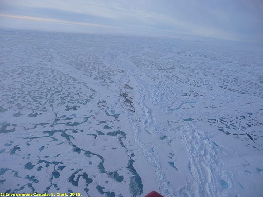
Concentrated sea ice. Melting ponds and pressure ridges show it will be hard to travel through.

Less concentrated sea ice. Puddles and cracks show the easiest way to go.
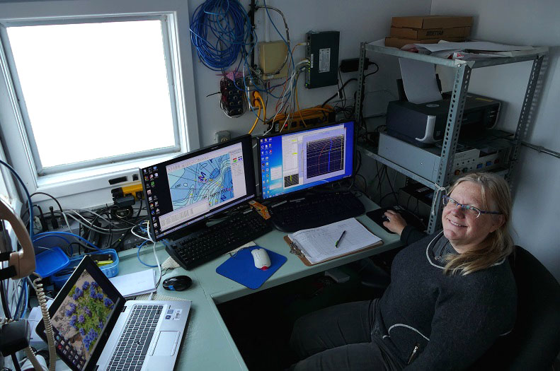
Lab tour: Oceanography laboratories
The CCGS Louis S. St-Laurent was upgraded for oceanographic studies in 1994 before its first trip to the North Pole. Every summer since then, oceanographic work for different research projects has been done in the Arctic on board the Louis. Jane and Hugh, oceanographers on the 2016 Canada Sweden Polar expedition, have been on most of these expeditions, Jane first participating in 1999 and Hugh in 2002.
This year, their sampling will characterize the physical, chemical and biological properties of the Arctic Ocean. Jane and her team at the Institute of Oceanographic Sciences (IOS) are looking to determine how Pacific and Atlantic waters travel across the Arctic Ocean. To answer that question, they use three methods: CTD/rosette sampling and profiler, XCTD profiler and near-surface water sampling.
The oceanographers have many hideouts on board the ship to collect, analyze and store all the data and samples. Here they are, deck by deck:
300 level deck: Four containers and a launching platform
On the left side of the deck, two containers are combined to form the rosette lab. This is where the CTD/rosette is stored and the sampling is done when it comes back on board.
On the right side, two containers are divided into three spaces: the CTD lab, the fume hood lab and the salt and dissolved oxygen labs.
The CTD lab is where Jane operates the rosette. In it, you will find computers, the deck unit that controls the CTD and computer screens showing data in real time when a CTD cast is being done.
The other container is a dissolved oxygen lab and salt lab. The temperature in this lab is controlled as the salinometer is very sensitive to changes in temperature. A steady temperature also benefits the dissolved oxygen analysis.
Rosette deck: Rosette lab (left) and CTD lab (right)
Fume hood lab, CTD lab, Salt and dissolved oxygen lab
Controlled temperature laboratory:
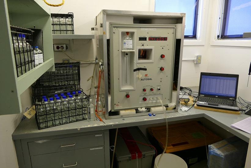
Salt lab
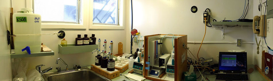
Dissolved oxygen lab
400 level deck: Main lab
A pump in the engine room pumps near-surface water to a thermosalinography instrument that records temperature, salinity and fluorescence. As part of my duties on board, I collect daily water samples from the thermosalinograph lab for the micro-plastic research lead by Peter Ross at the Vancouver Aquarium.
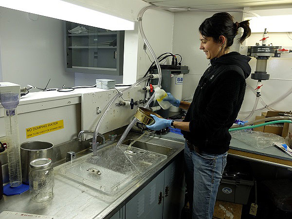
Thermosalinograph lab
On the other side of the window, Hugh measures chlorophyll concentrations in seawater. Phytoplankton, which contains chlorophyll used for photosynthesis, is an indicator of the productivity in the ocean since phytoplankton are at the base of the food chain.

Chlorophyll lab
A DNA/RNA filtering station is also set up on a workbench near the chlorophyll lab. Jane filters samples here from the rosette for the University of Laval and Concordia University.
500 level deck: The aft deck and XCTD launch platform
XCTDs are launched and monitored on the 500 level deck, by the aft deck (stern) where the geophysical gear is towed. In a small area, just inside the deck, a monitor has been installed to receive conductivity, temperature and depth measurements from the XCTD probe that sinks until the thin copper wire is broken. On this deck, samples are also stored for later analysis in two walk-in freezers and a walk-in refrigerated room.
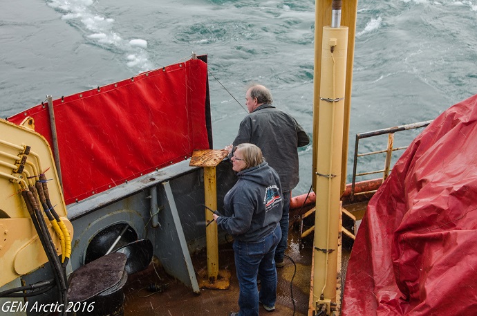
Aft deck, XCTD launching
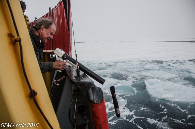
XCTD launching

XCTD monitor
Down at the bottom of the deep blue sea...
I have talked about the rosette several times on Twitter and in an earlier post. This instrument -- also referred to as a CTD -- which stands for conductivity (from which salinity is calculated), temperature and depth -- is used by the expedition’s Fisheries and Oceans Canada oceanographers to collect seawater samples and to obtain data about physical properties of the water column.
What is it?
A rosette is a steel frame that houses a CTD in its centre and has specialized Niskin bottles attached around the outside of the frame that are used to collect seawater samples. The CTD package, including the sampling bottles and sensors, has to be able to withstand pressures at a maximum depth of 6,000 metres.
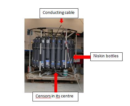
A variety of instruments and sensors measure data in real time and send the data up to a laboratory on the ship through the conducting cable. They provide data on temperature, conductivity, pressure, oxygen concentrations, light levels, etc. Additional instruments can also be attached to the frame to read chlorophyll fluorescence (a measure of the amount of phytoplankton), particle concentrations and other information.
The rosette on the Louis is configured with 24 10-litre Niskin bottles and collects data on seven physico-chemical and biological properties with its sensors.
How is it used?
The rosette is lowered into the ocean using a winch and a conducting cable straight over the side of the ship at specific locations, as needed by the research project. As the package descends through the water column, the CTD operator continuously monitors the data being sent back up to the laboratory and can see the profiles of temperature and conductivity/salinity as a function of depth. The Niskin bottles are closed remotely to trap a sample of seawater from the desired depth. Once the rosette is back onboard, the water is transferred from the collection bottles to sample bottles. Some samples are analyzed right away, and others are stored or frozen until the ship returns to port.

Rosette is lowered into the ocean using a winch and conducting cable
Why is the CTD rosette being used in the Arctic Ocean during this expedition?
Jane Eert of the Institute of Ocean Sciences, Department of Fisheries and Oceans, in Sidney, British Columbia, has been gathering data to understand how water masses originating in the Atlantic and Pacific Oceans flow into and circulate around the Arctic Ocean. Temperature and salinity data are used to identify where the water mass originated. Observations in recent years have shown that water masses flowing into the Arctic Ocean have altered temperatures and salinities, and these differences have an impact on the region.
It’s an impressive instrument that is providing surprising and highly useful data about the ocean’s interior.
Lab tour: Hydrography laboratory
On the third deck of the starboard side of the ship, looking forward over the bow, stands the hydrographic lab: the epicentre of the mapping work for the survey.
Specialists from Fisheries and Oceans Canada’s Canadian Hydrographic Service (CHS) use a multibeam acoustic system to measure the changing depth of the water and thus determine the shape of the seabed. The team is led by the hydrographer-in-charge (HIC), who oversee s the entire operation and ensures that the system is operating properly and that high-quality data is being collected. The HIC is responsible for the survey plan and works with the chief scientist and ship’s captain to make sure the survey’s objectives are met. Hydrographers work in the laboratory on twelve-hour shifts, collecting and processing data around the clock. An electronics technician makes sure that the system is running optimally.
Two bathymetric measurements are critical for defining the outer limits of the extended continental shelf. The first is the location of the foot of the slope: the maximum change in gradient between the continental slope and the seafloor. The second measurement is the position of the 2,500-metre isobaths, the points where the water is 2,500 metres deep.
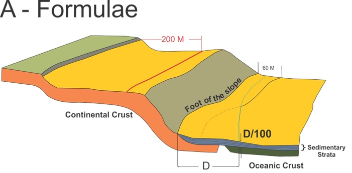
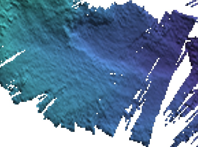
As we sail through the Arctic Ocean, the multibeam continuously measures the water depth beneath us to map the seafloor. In addition to using this information for Canada’s submission, all the data we collect will be included in the International Bathymetric Chart of the Arctic Ocean.
The multibeam system is mounted in the hull of the ship and connected to the laboratory with the many cables and wires that you can see in a room on the 600-level deck. The laboratory has eight computers: two display and process the data to remove any faulty information known as “noise,” and the other six show live feeds of the data as it is acquired, as well as running various software programs to control the multibeam system, visualize the seafloor and track the ship’s navigation. These latter functions show where we are on pre-determined survey lines and measure the ship’s movement of as we go up, down and sideways through ice and water.
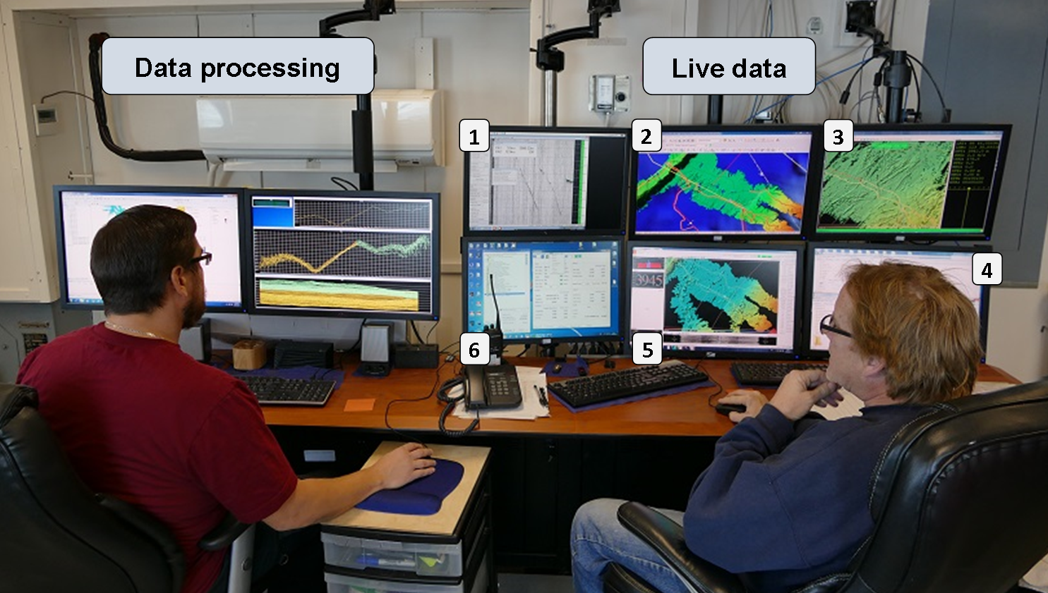
| Data processing |
| Live data |
| 1. Sub-bottom geophysics live data |
| 2. Global mapper; Historical and previous mapping MB data sets |
| 3. Helmsman Display; Connection to the bridge for routes |
| 4. Multibeam settings and control |
| 5. Show the real-time data collection |
| 6. Position Orientation System for a moving Vessel; Records the ship heave, pitch and roll for the multibeam to autocorrect its data |
A hydrographer is on duty in the lab at all times and responsible for operating the multibeam system to ensure high-quality data is acquired and processing the raw data to remove the noise.

Hydrographic laboratory in numbers:
- The multibeam system has 864 beams and can make measurements down to 11,000 metres.
- Each beam sends high-frequency sound waves to the bottom of sea and measures a single depth point.
- At 4,000 m depths, a swath of 864 beams is made approximately every 15 seconds.
- The width of the swath is approximately four times the water depth (the 864 points are dispersed over the width), so that, e.g., at 4,000 m depths a 16 km swath of data is collected.
- In an hour, about 180,000 data points are collected.
Sailing the Arctic Ocean
When talking about the Arctic, it is natural to think about land, tundra, fjords, ice, people, caribou, polar bears, whales and seals. My past experiences brought me to communities with hunting stories, adapting traditional way of life and settling realities surrounded by breathtaking landscapes.
This time, I am on a ship, in the middle of an icy ocean, with a crew mainly composed of Newfoundlanders! So this may not be a “typical northern experience” -- it’s more like an Arctic Ocean adventure -- experiencing life on a Canadian Coast Guard ship and culture of Atlantic Canadians! It makes a noteworthy difference.
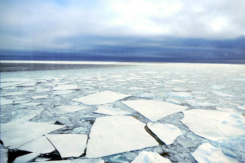
New ice -- typical scenery in the Arctic Ocean
It is quite a feeling to be in the middle of the Arctic Ocean. Far, far away from shore (500 miles), with very little wildlife present, it’s pretty desolate -- ice, water and the ship are all you can see. For a month and a half, you follow the ship’s schedule: breakfast at 7:30 a.m., break at 10:00 a.m., dinner at 11:30 a.m., break at 3:00 p.m., supper at 5:30 p.m., and from time to time, evening activities.
From the few windows, you see ice, water and light, no matter what time of the day it is. The ice changes -- it gets thinner, thicker, blue, white, pressure rides higher, sharper, rounder. Then the ship makes its way to a puddle and follows a series of puddles before hitting ice again.
Very close pack ice with a crack to cruise through.
Your whole body feels a constant subtle shaking of the engines and their ongoing hum. The ice scraping the side of the ship is loud and makes the boat bump sometimes. The science makes its own noises too -- from mapping and geophysical samplings (beep, psssh, boom).
Is that what you imagined of a journey in the middle of the Arctic Ocean?
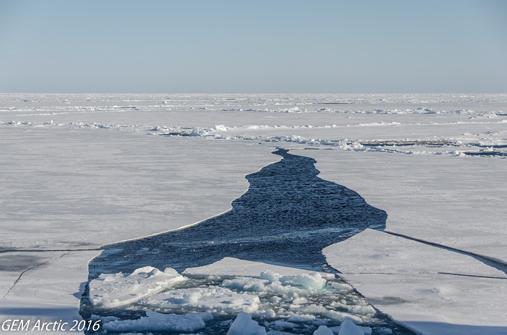
There is also the fascinating part where you stop and think that you are sailing over a few thousand metres of water. When you look at the ice and wonder: How old is it? How far has it travelled around the ocean since it was formed? And when you actually see new ice form right in front of your eyes and grow every day for the winter, and maybe many years, it is just amazing. Every bird, fish, or seal makes you rejoice -- just because it is life!
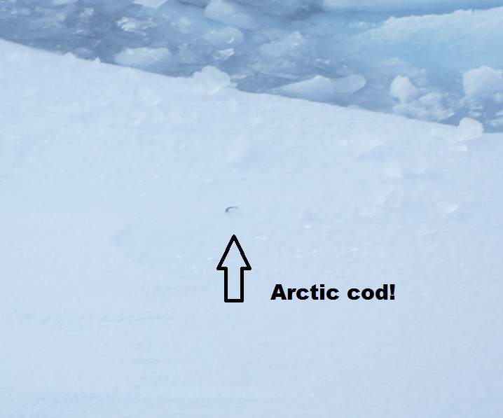
LIFE! First fish I saw in the Arctic Ocean (September 10)
I don’t know what it is I expected from this journey. I am still amazed at the feeling of being in the middle of an ocean, so isolated from society. Sea life is like nothing I know. And as challenging as it is in many ways, it is also extremely soothing. The extreme isolation and emptiness reminds you of one thing: you are alive.
The Arctic Ocean
As I talked with Jane, oceanographer on board the 2016 Canada-Sweden Polar Expedition, we quickly broke the surface of the ocean world and plunged directly to the deep enigmas of the Arctic Ocean. It's as if all oceans have their own personality depending on the special combination of their waters, currents, climate, fauna and human communities. Each one carries its own mysteries and stories as it has evolved through the geological ages.
The Arctic Ocean has its own unique set of tales that have been kept alive in the vivid legends and sagas of the Western World and the much older Indigenous mythologies. As a result, a voyage of wonder awaits all those who explore its waters. And in addition to its stories and legends, the actual physico-chemico-biological properties of the Arctic Ocean are no less striking, and I want to tell you more about them.
The Arctic Ocean is unique, and in so many ways. First, it is the smallest ocean in the world. Secondly, it is unique geographically because it is surrounded by continents (North America and Eurasia) and thus extends over large continental shelves. Thirdly, it is largely isolated from other oceans and is mostly covered by ice.
Under its distinctive ice cover, the ocean currents are complex. Jane put the water mass dynamics simply for me: the Arctic Ocean is a large reservoir through which the waters of the Pacific and Atlantic Oceans pass. The cool and less salty Pacific water enters the Arctic Ocean through the Bering Strait between Russia and Alaska, while the Atlantic's warm and salty water enters by way of the Fram Strait off Greenland and the Barents Sea.
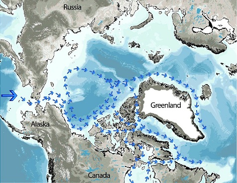
Pacific water circulation
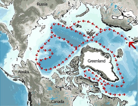
Atlantic water circulation
As the Pacific and Atlantic waters move around the Arctic Ocean basin and mix over the course of many years, their heat is transferred and their temperatures are modified, until finally the water masses -- now with new thermal characteristics -- leave the Arctic Ocean and circulate throughout the Earth. As a result, the Arctic Ocean's heat budget plays an important role in the global oceanic cycle that maintains the Earth's climate.
That's what happens below the ice. As for the ice cover itself, it affects two things: light reflection (known as the albedo, or brightness, effect) and salinity. As it is white, ice is highly reflective and so bounces the sun's rays and the heat they carry back to the atmosphere. Yet when the rays strike the dark open water, their heat is absorbed. As a result, on the vast, oceanic scale of the surface area involved, the balance between reflected and absorbed heat greatly affects the ocean's temperature and, in turn, global climate.
When the surface temperature falls, the sea ice freezes and expels salt until the point when the ice thickens and ages and becomes pure, but frozen, water. The resulting brine rejection creates huge amounts of salt re-entering the ocean in the winter. Then, as the surface water becomes saltier and colder, it becomes more dense and sinks to great depths in the ocean, travelling slowly around the world in bottom currents and affecting local habits.
Many other complex processes -- physical, chemical, biological -- occur in the Arctic Ocean, and just as the brief summaries given here show, they play important roles in the Earth's climate. As far as it is from our homes and daily life, the Arctic Ocean helps to stabilize climate, allowing us to live in the world as we know it.
End of the 2016 Canada–Sweden Polar Expedition
While my official “Teacher at Sea” experience ended on September 20, the “end of mission” feeling started many days before we actually set foot in Kugluktuk, on the northern mainland coast of Nunavut, to take our charter flight back to St. John’s.
Our last few days at sea were marked by many “lasts,” each of them making us feel closer and closer to our return to our loved ones.
On Sunday September 11, under a beautiful sun, the geophysical gear was recovered from the water for the last time. It marked the end of geophysical data collection for the expedition.
The geophysical equipment was put back on its cradle for the last time
On Tuesday, September 13, the last CTD cast to the bottom of the sea took place, to a depth of 3,800 metres. It was also when I did my last micro-plastic sample for the research led by Peter Ross at the Vancouver Aquarium.
On Friday, September 16, a recognition night was held in the forward lounge to thank Captain Potts and the officers and crew of the CCGS Louis S. St-Laurent for their exceptional support to the UNCLOS scientific program. Ship and scientific personnel received several presentations: a North Pole certificate, a 2016 UNCLOS program badge and a water sample taken from 4,200 metres below the North Pole.
Mary-Lynn, Jane and Captain Potts handing out the end-of-trip goodies: certificate, badge and water sample
On Saturday, September 17, we saw land for the first time since we left Svalbard on August 10. As we entered Amundsen Gulf, John Ruben and Nelson Ruben, the two mammal observers on board, were getting ready to head back home in Paulatuk on the northern shore of mainland Northwest Territories.
The end-of-the-trip feeling grew stronger as the two men left. As we got closer to shore, we also started receiving a satellite connection to live TV! After having only onboard TV channels, the return of a news channel made us feel connected to society again.
John Ruben and Nelson Ruben heading home to Paulatuk, NT
On Sunday, September 18, we reached our final destination and anchored off Kugluktuk. That was it. The bathymetric survey finished collecting seafloor data, officially ending the scientific program for the expedition.
Meanwhile, crew members were busy getting the ship ready for a crew change. The scientific crew was backing up data and packing up gear. We were reduced in numbers again when James Quast, one of the two helicopter pilots, left to fly a helicopter all the way back to Halifax.
Anchor going down offshore Kugluktuk
On Monday, September 19, all that was left to do was to visit the schools of Kugluktuk. John Shimeld, geophysicist, Dave Thornhill, hydrographer, Kenneth Wong, foreign affairs officer, and I were flown into town to meet with high school and elementary students. It was really nice to share what we had been seeing and doing over the past weeks, with two feet on the ground, in front of new faces! Both schools were extremely welcoming and interested in the science of this expedition and Canada’s Extended Continental Shelf Program.

Emilie addressing captivated Kugluktuk elementary students

After six weeks on a ship, a little walk in the tundra is priceless!
On Tuesday, September 20, our luggage was flown ashore by the remaining Coast Guard helicopter first thing in the morning with the sunrise. We followed after in groups. Once at the airport, we waited and saw the new ship’s crew arrive and then depart for the ship in groups as we boarded our plane to St. John’s. The next day, I made it back home to Montreal, safe and sound. And now, I’m writing these words with my cat beside me, big trees outside and amazing September warm weather!
Luggage being moved ashore in the sunrise
What a great journey this has been, for all the people involved and for the research project as a whole. Thanks to the Canadian UNCLOS program for allowing me to sneak and peek on the CCGS Louis S. St-Laurent for the 2016 Canada–Sweden Polar Expedition. This was truly an experience of a lifetime!
Last sight of CCGS Louis S. St-Laurent from the helicopter