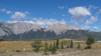
For millennia, First Nations peoples knew the Canadian Rockies as sacred places, but little was known about their geology before observations by James Hector of the Palliser Expedition (1857-1860) and studies by Geological Survey of Canada geologists George Dawson in the 1880s and Richard McConnell in 1886.
The spectacular scenery and pronounced linear nature of the southern Rockies certainly required a geological explanation. Hector and Dawson offered hints, but it was McConnell who filled in the blanks by being the first to recognize their fold and thrust origin.
He reported, “The dominant structural features of the eastern district (mountain front) ...are due to a series of gigantic thrust faults, which have carried the older formations forward, and placed them...above the highest beds of the series. One of the largest and most important of these occurs along the eastern base of the chain, and brings the Cambrian limestone of the Castle Mountain group over the Cretaceous of the foot-hills. This fault has a vertical displacement of more than 15,000 feet, and an estimated horizontal displacement of the Cambrian beds of about seven miles in an easterly section.” The fault today bears his name.
Category: Science Advances
Decade: 1880s
References
Price, R.A., 2000. The Southern Canadian Rockies: Evolution of a Fold and Thrust Belt; GeoCanada 2000, Field Trip Guidebook 13, Canadian Society of Petroleum Geologists; Calgary, Alberta, 244 p.
Gadd, B., 2012. Operation Bow-Athabasca – The Geological Survey of Canada Takes on the Rockies; Canmore Museum and Geoscience Centre, Canmore, Alberta, 72 p. [including CD-based digital versions of all 39 published Bow-Athabasca 1:50 000 scale maps and cross-sections]


