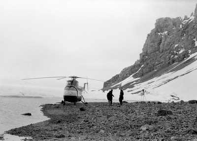
In the late 1940s, Canada and the United States established a network of five jointly staffed weather stations in the Arctic Islands. This proved to be a boon for the Geological Survey of Canada. Use of the weather network’s airstrips and communications systems allowed the Survey to dramatically increase its geological mapping and research in the High Arctic. It carried this out by embarking upon an era of large-scale, multidisciplinary expeditions supported by helicopters. The most ambitious was Operation Franklin in 1955, which used Resolute, Cornwallis Island, as its principal base.
Led by Yves Fortier, who was later to become the Survey’s director (1964-1973), the 28-person Operation Franklin used two S-55 Sikorsky helicopters to study and map 260,000 square kilometres of remote Arctic terrain. Geological features discovered and made public from Operation Franklin triggered intense industry interest in northern oil and gas exploration. Between 1981 and 1986, 176 exploration wells were drilled, resulting in the discovery of large natural gas and oil resources.
Category: Exploration
Decade: 1950s
References
Nassichuk, W.W., 1987. Forty Years of Non-Renewable Resource Development; Journal of the Arctic Institute of North America, v. 40, no. 4, p. 274–284.


